

The Top Mountain
A tale of Blue Sky, Green Grass, and the Folded Rocks

The Southwest monsoon is now over in Southern India and the winds of Northeast monsoon have started to blow. Between the transition of wind from Southwest to Northeast, there is usually a golden window of few days to a week where the air is free of particulate pollution and the mountains are clear from cloud, allowing for long range visibilities.
One such fine Sunday, I woke up to the clear blue skies and decided to hike a nearby mountain with one of my friends. The mountain is called the “Top Mountain” affectionately in the local language and sits at an elevation of 1659m above sea level.
The Route
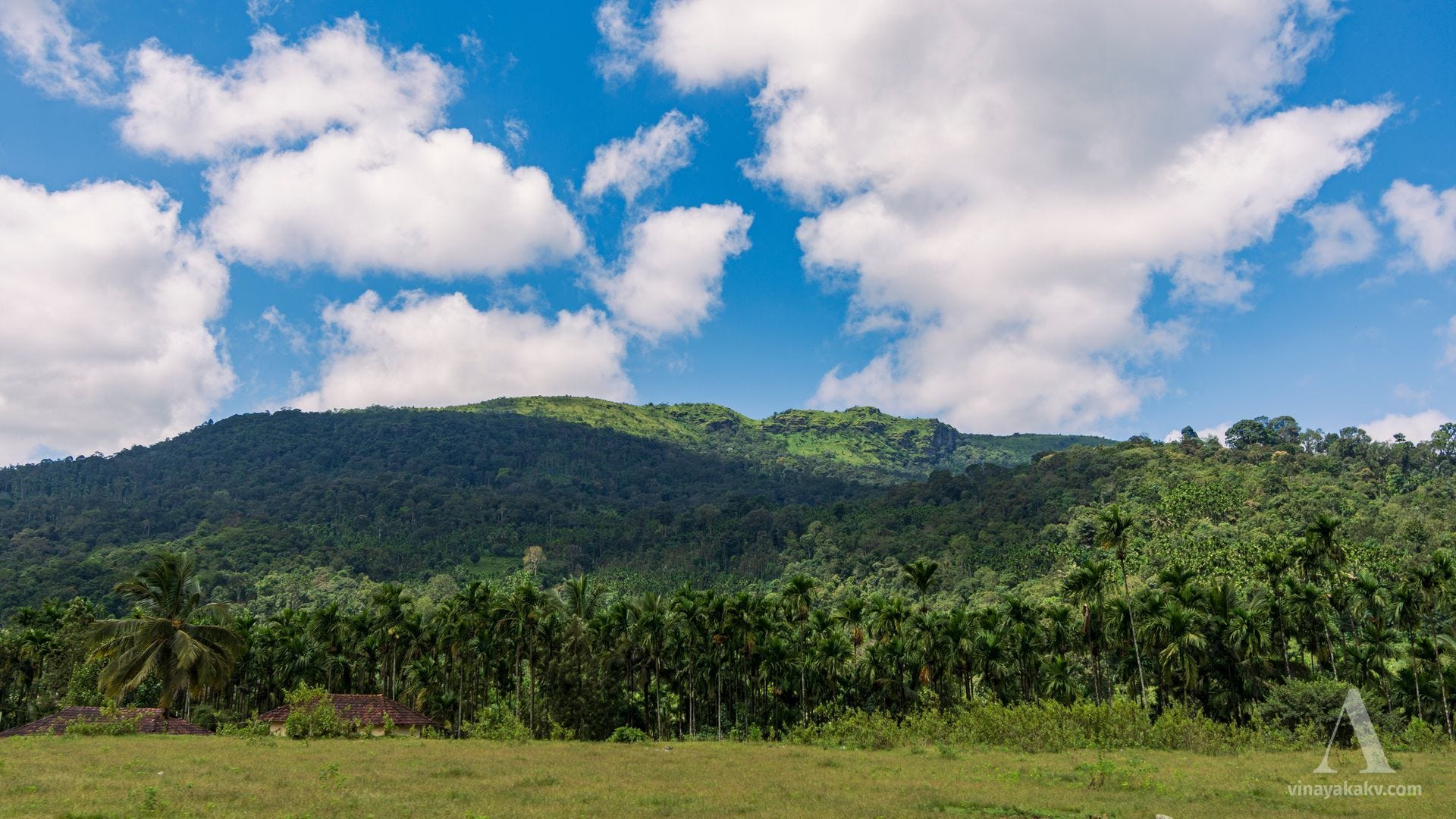
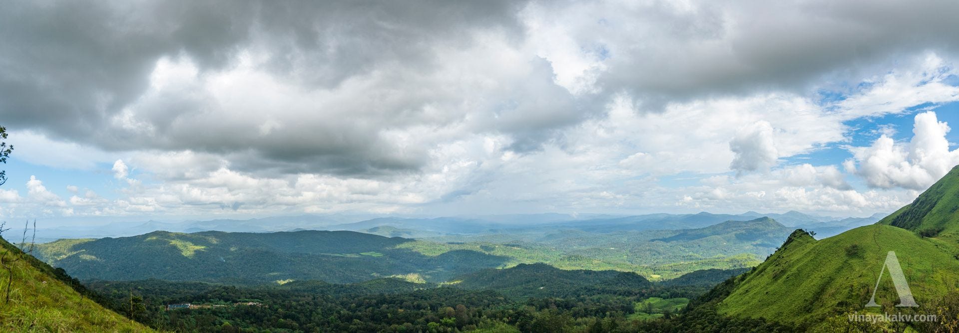
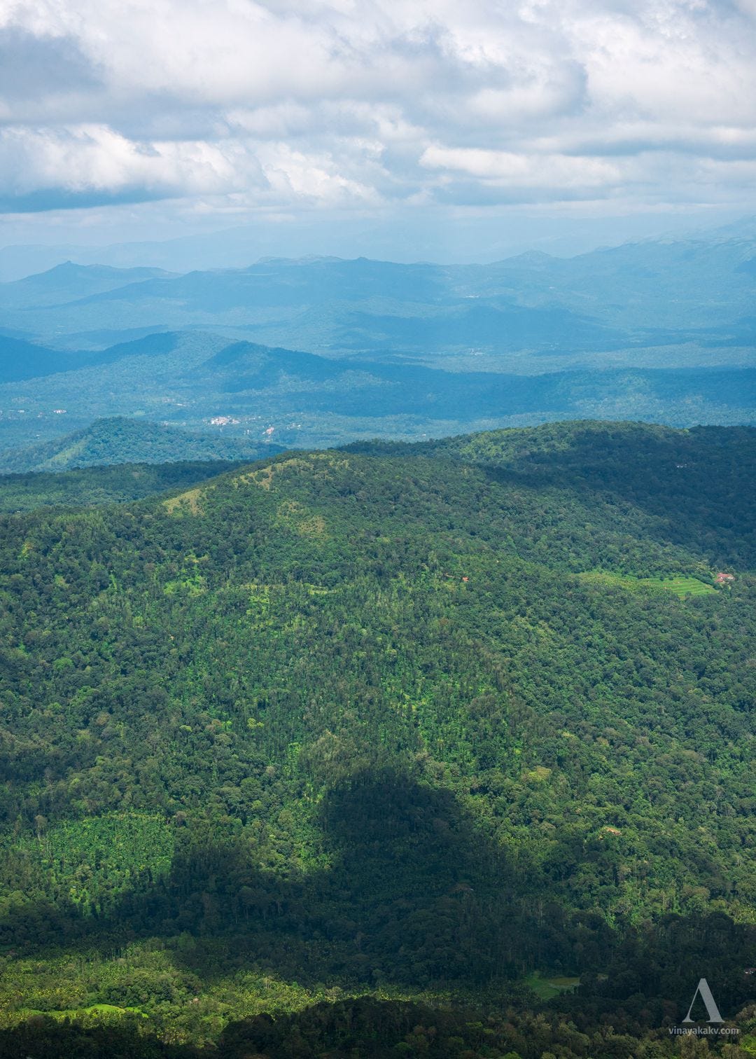
The route to the mountain is mostly navigable, thanks to the coffee and tea plantations extending (and encroaching 😅) till the base of the mountain. In the route, we slowly gain elevation and get a nice view of the mountain and the surroundings.
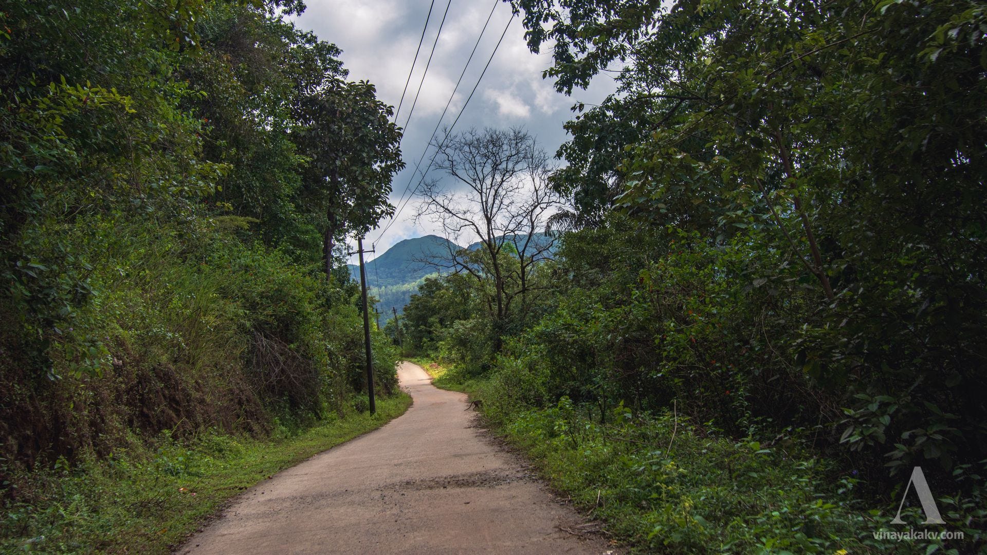
As we near our mountain, we see its side ranges, which also have a good deal of elevation.
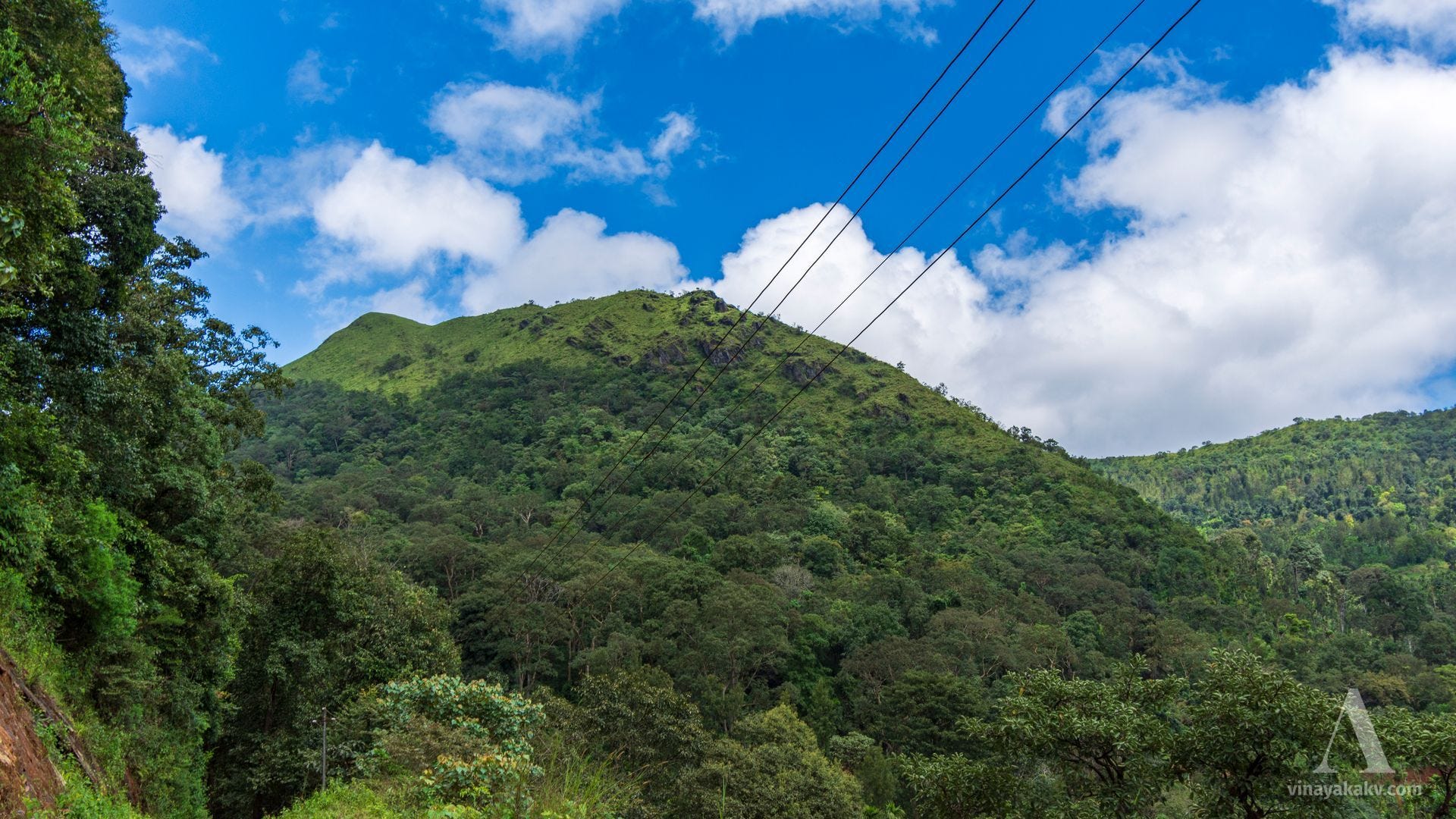
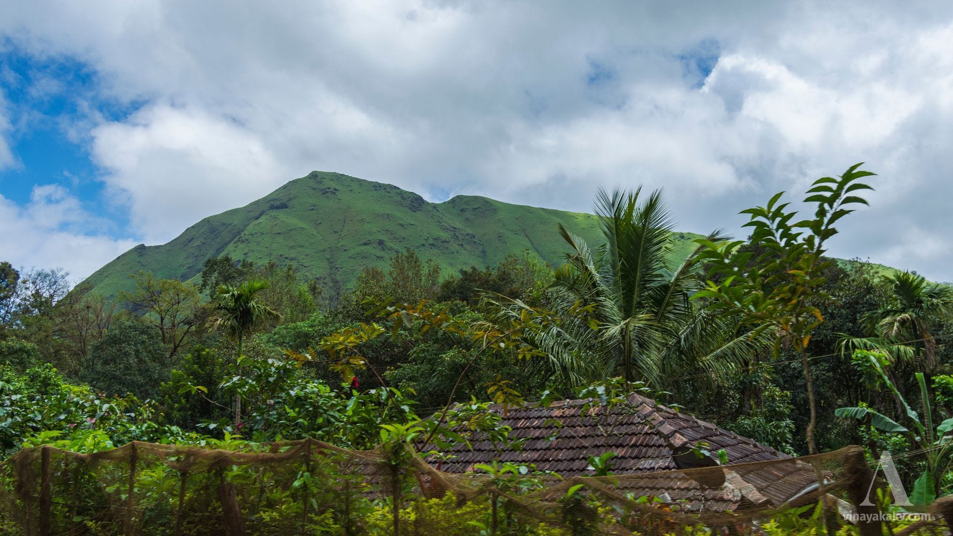
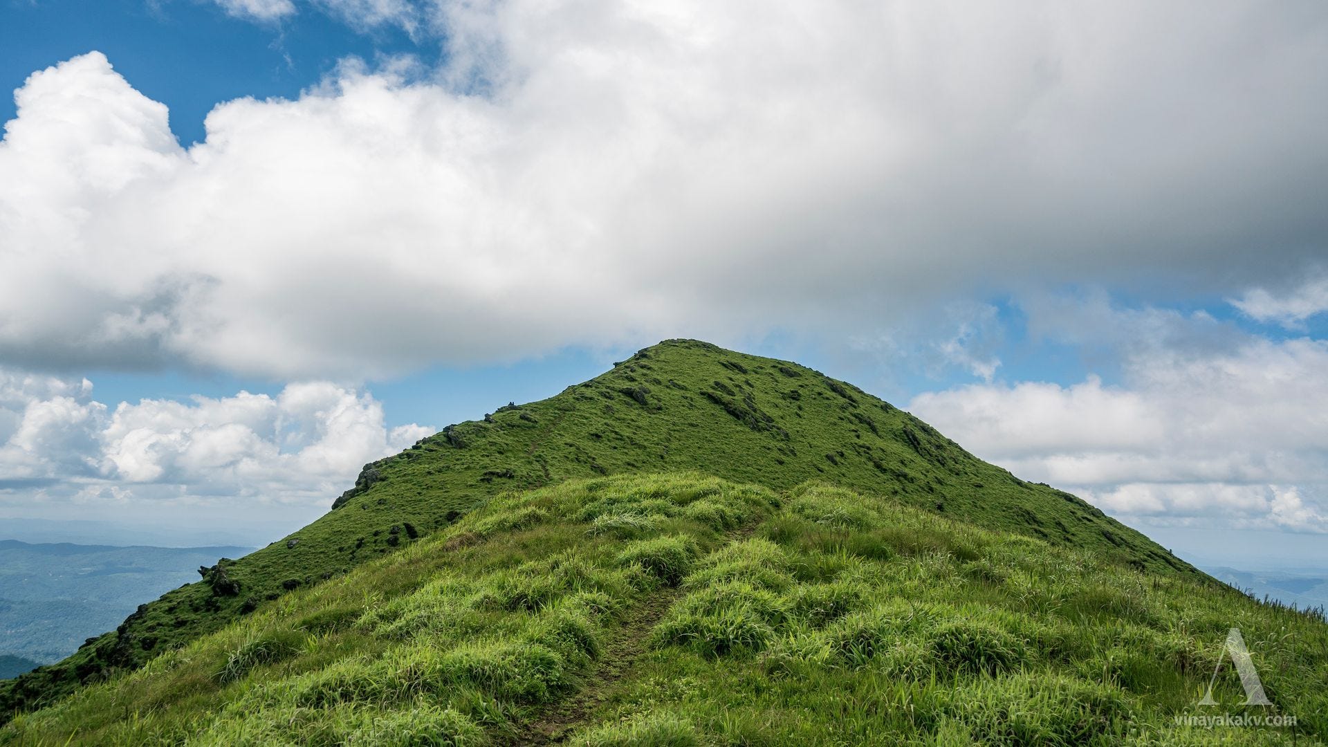
Finally, when we arrive at the base, we are welcomed by the grandeur of our destination.
The Hike
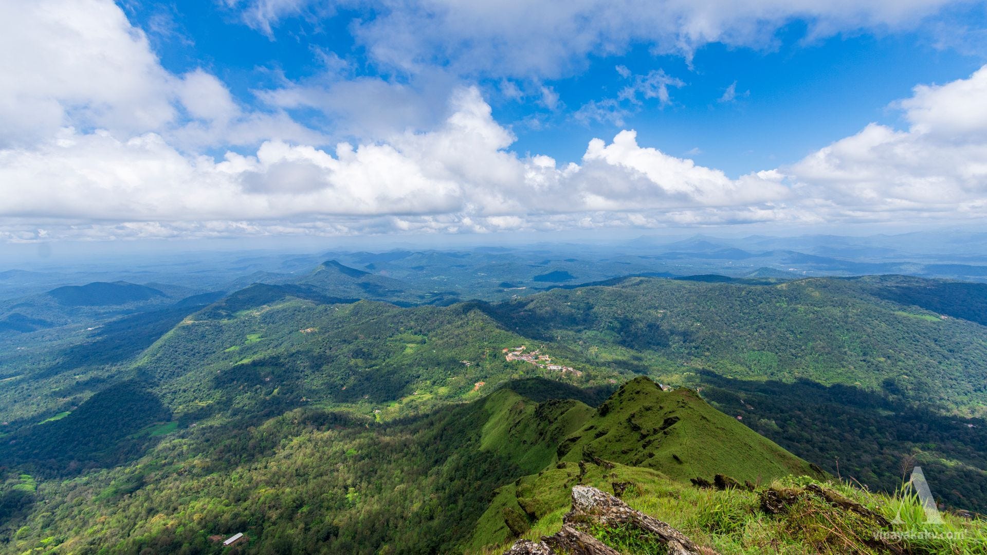
As you see from the photo above, the most logical way to hike this mountain is from the gentle sloping side that runs right-left in this image. This path takes us through a coffee plantation, and then opens us to the montane grassland. In the past, we did a mistake of climbing this mountain by its side, which proved to be tiresome!
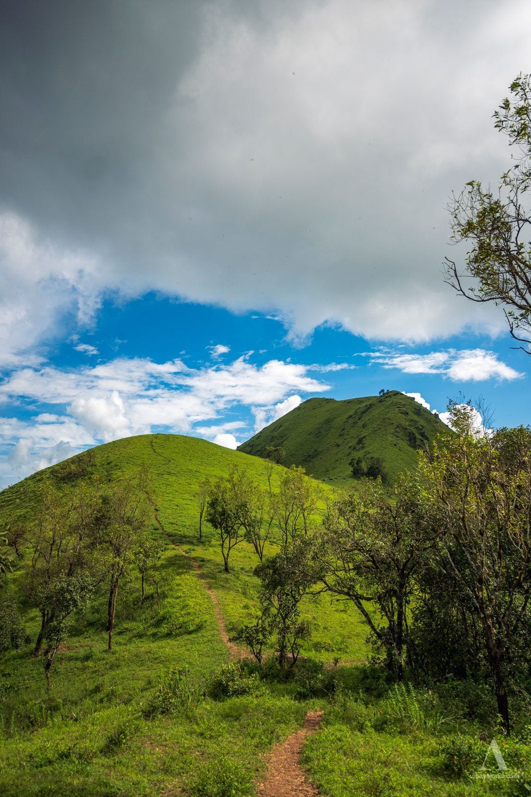
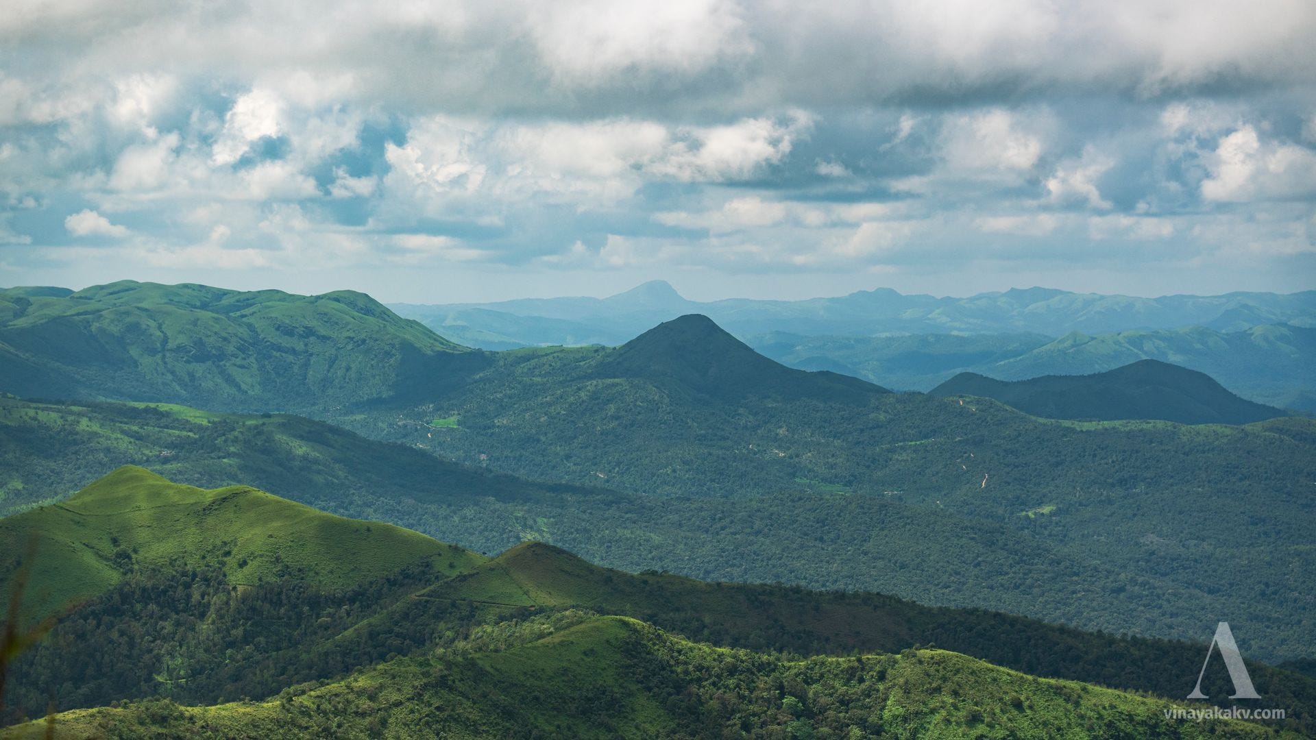
The route passes through several smaller sub-hills of this mountain, creating beautiful panoramas.
If you are observing enough, you will see the rocks beautifully bent and folded all over. These rocks are rich in iron and are called as Banded Iron Formations (BIFs). They formed in an ocean environment some 3700 Million years ago. The tectonic and mountain-building processes made them end up in the top of hill, now facing monsoon erosions. I will likely elaborate on the processes that happened here in a future day, when I’m confident enough about my knowledge!


The sub-hills also offer a nice view on route, helping to console tiredness from climbing.
Hills of various Shapes and Sizes
You are in for a wonderful view at the peak provided that the peak is free from clouds and the visibility is good. The experience is better summarized by the words of a late Chief Commissioner of Mysore and Coorg Provinces during British India, which got later quoted in the Gazeteer of the state.
“After a toilsome climb up its steep sides by the ‘windy gorge,’ one revels in a view which surpasses all expectation. On every side tower up hills of various shapes and sizes, stretching far away to the horizon, and presenting a wonderful spectacle of wild sublimity.”
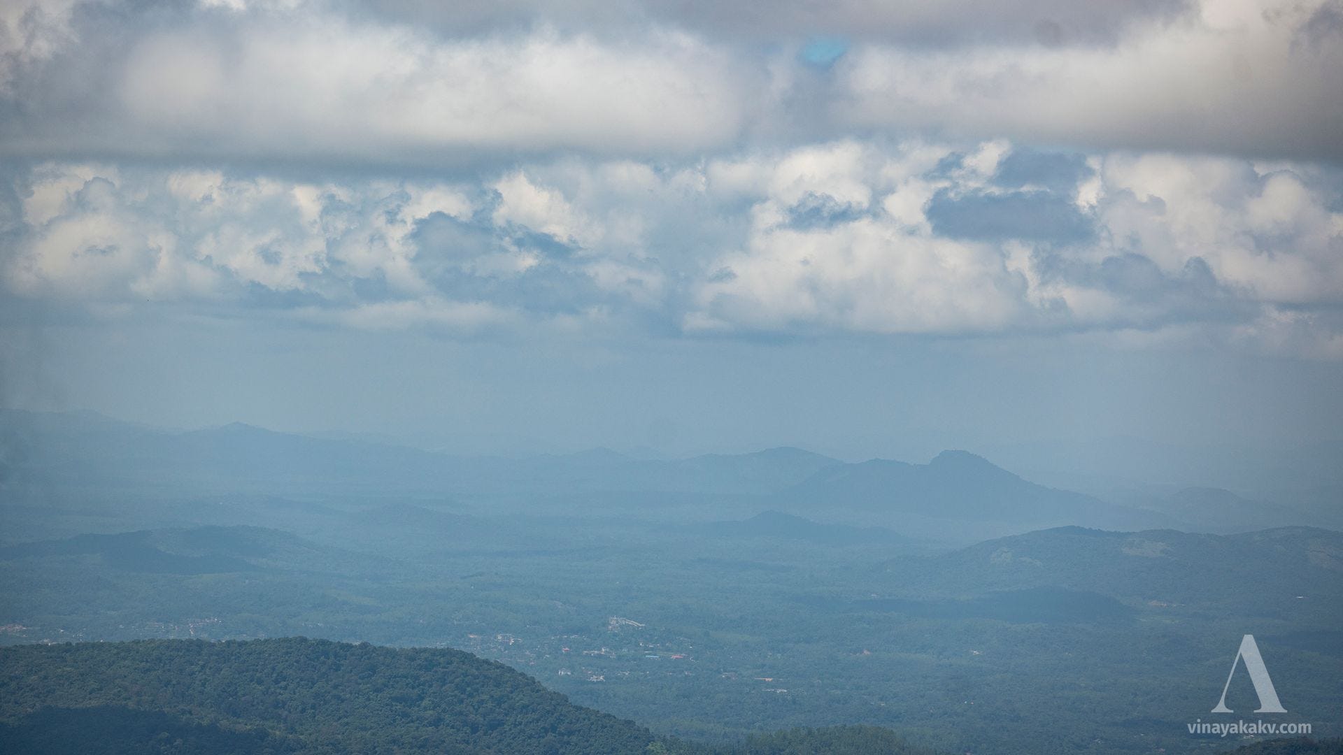
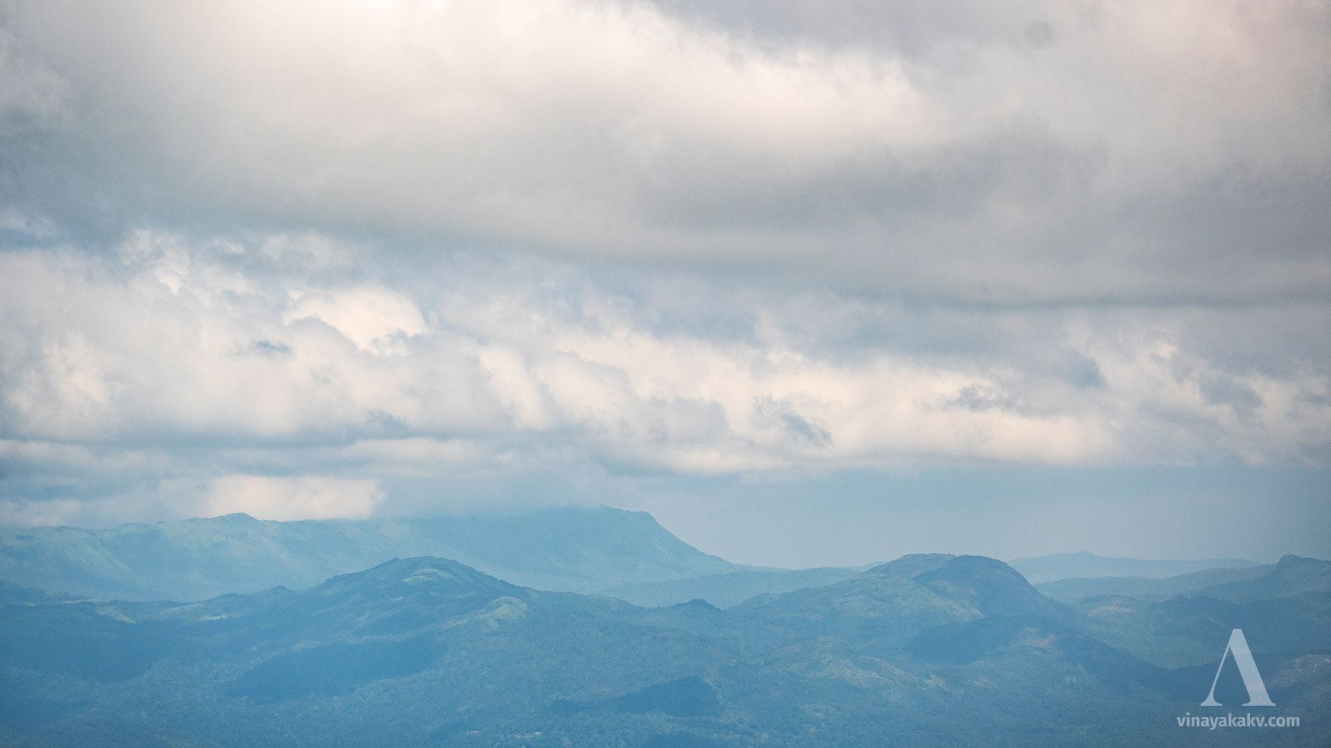
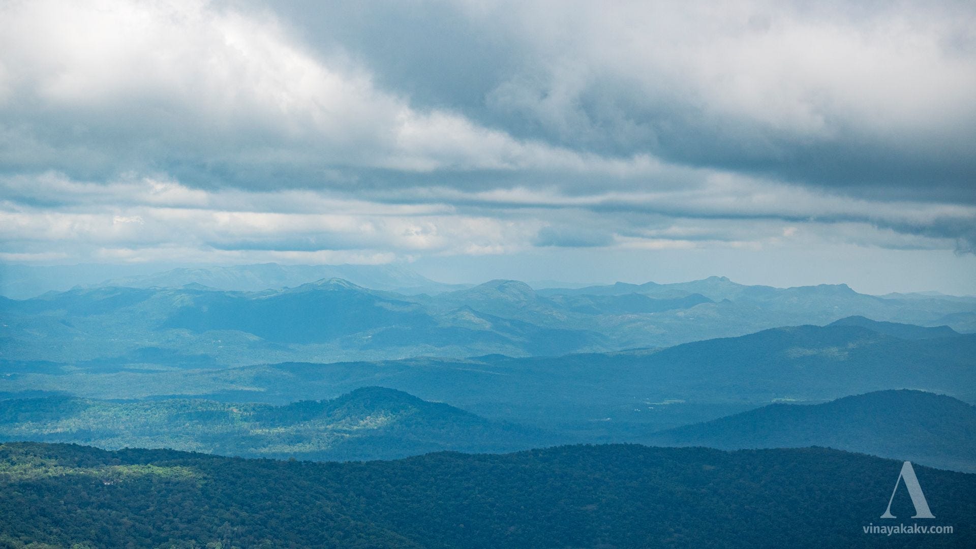
Although the visibility looked great for us when we started in the valley floor, the summit told us a different story. We could see a maximum of 40km radius, which can ideally be upto 80-100km given ideal conditions. In the northwest, we could see a little farther than the granite inselberg of Kundadri, near Agumbe.
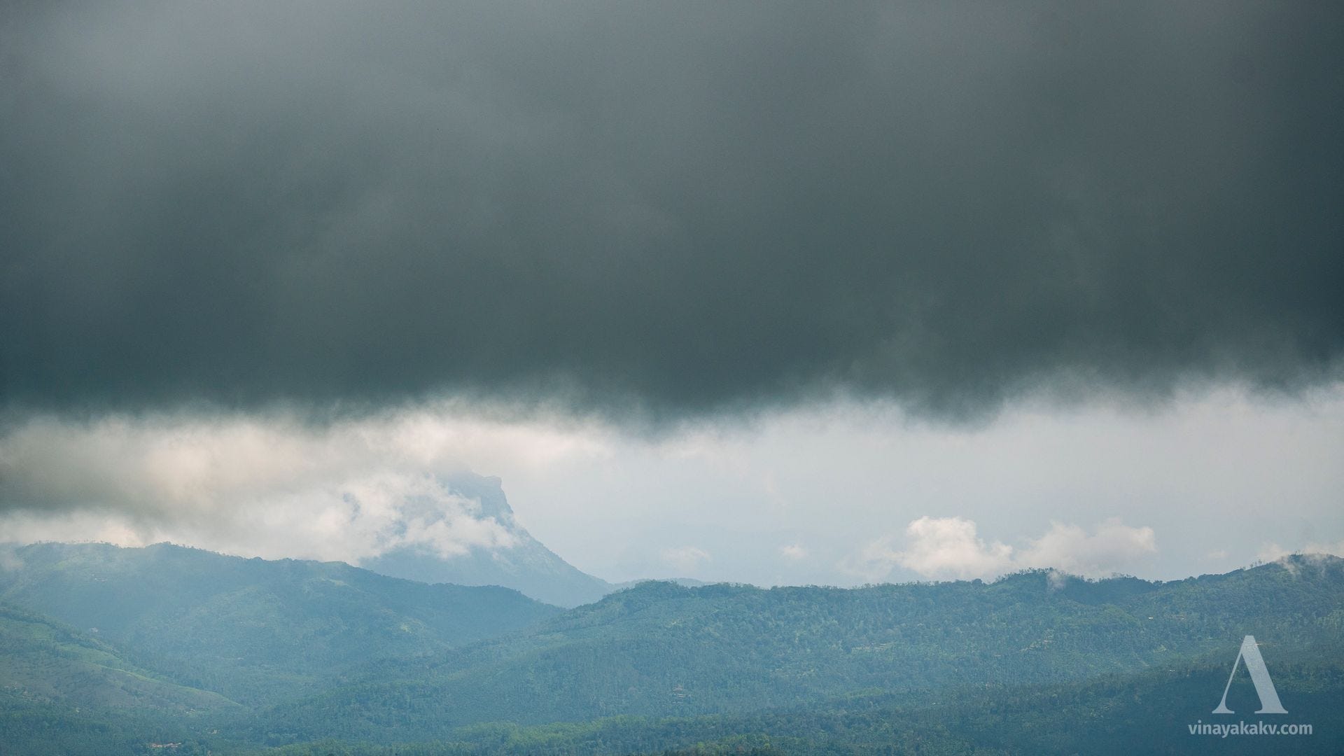
The tallest mountain in the Karnataka, Mullayyanagiri, was obscured with clouds.
The farthest point in the core Western Ghats that we could make out was Amedikkel, which is 36km away.
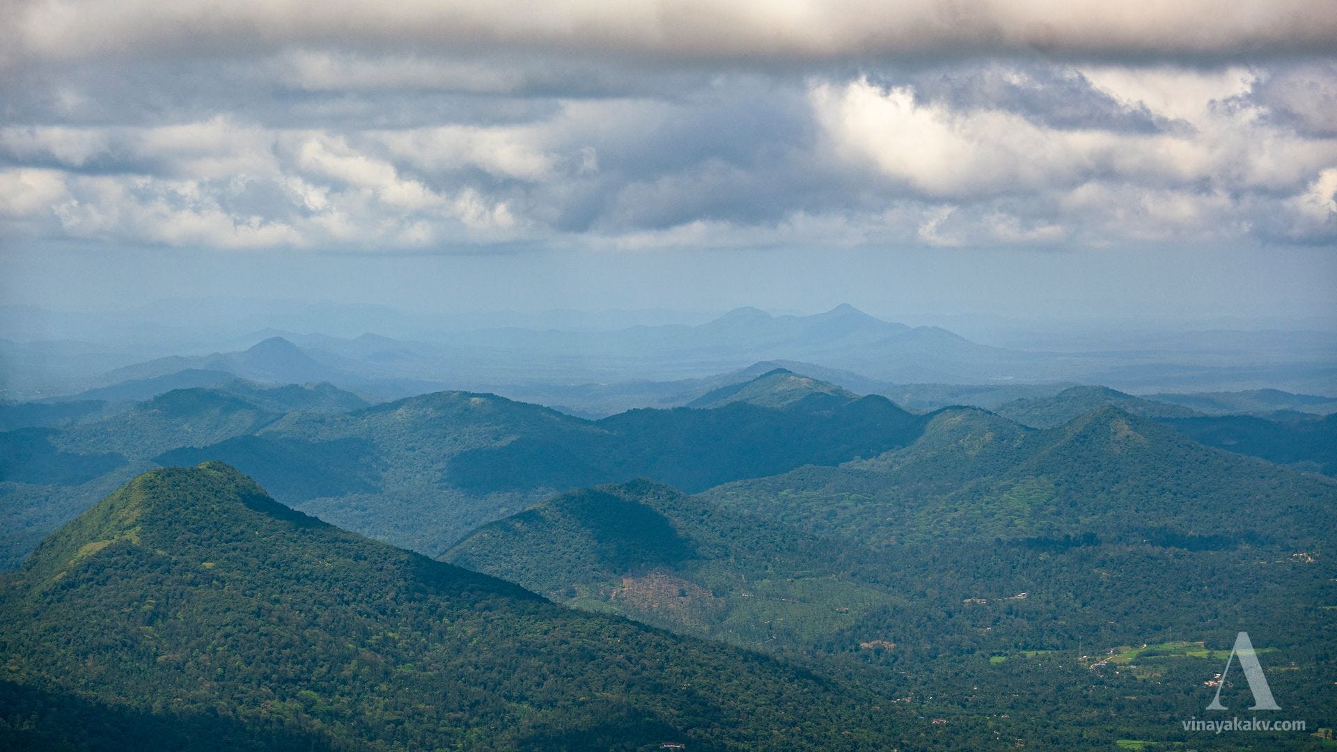
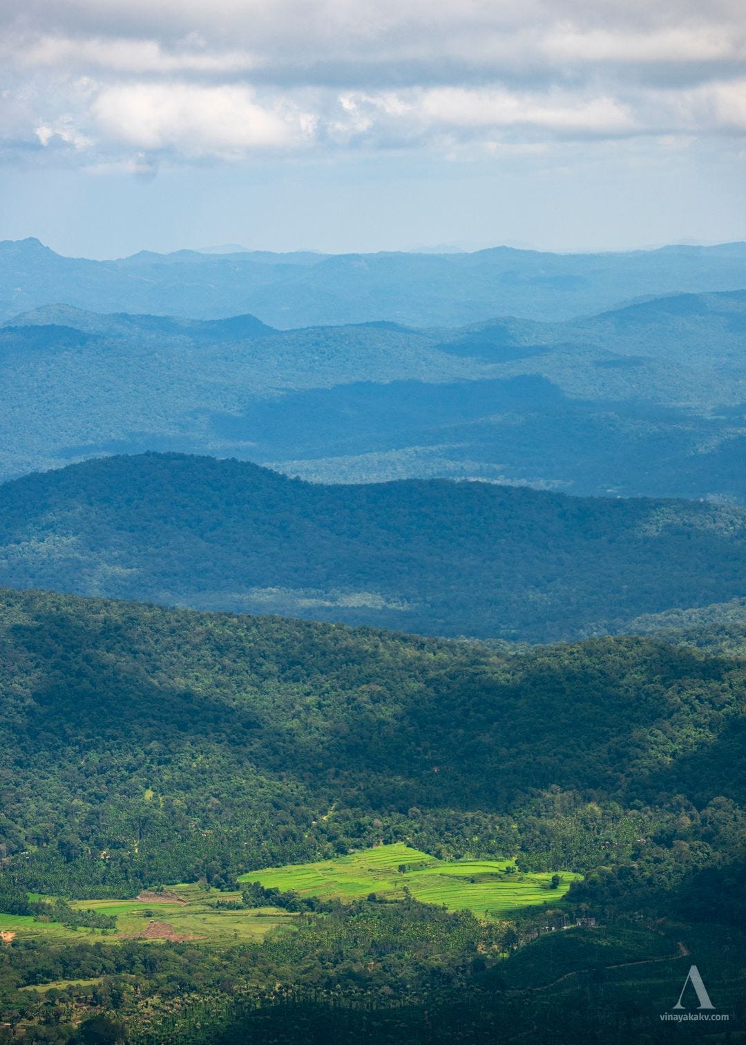
Although the long range visibility was impacted, whatever was visible with covered with shadows and lights, making up for a beautiful view.
The immediate mountains in the tail were visible clearly, hinting at the activities of the Tea plantations.
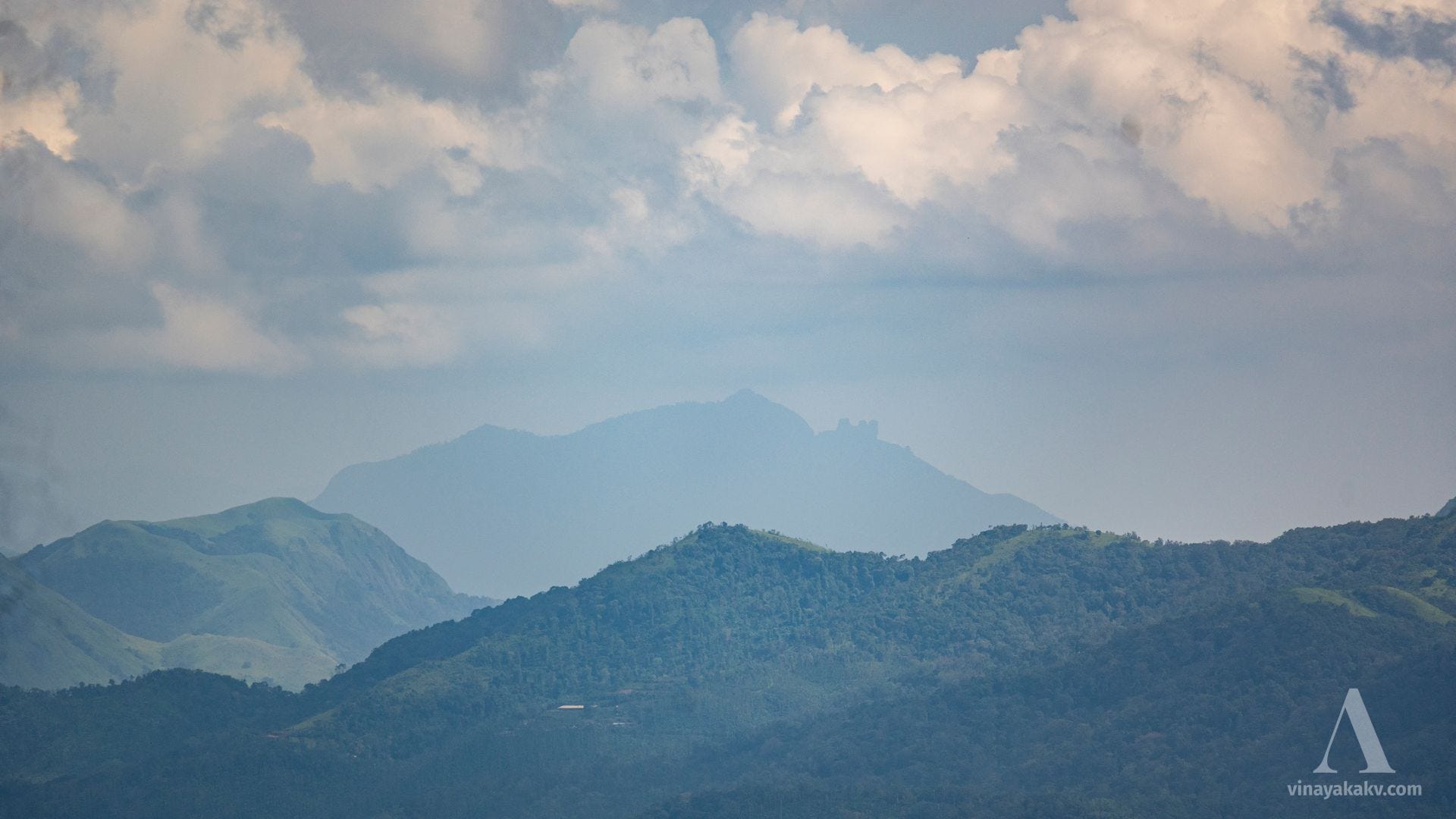
The side-ranges of the Chandradrona range compete with the elevation of this “Tall mountain”.
Another contender for the elevation is the Kuduremukha Range that stands mighty.
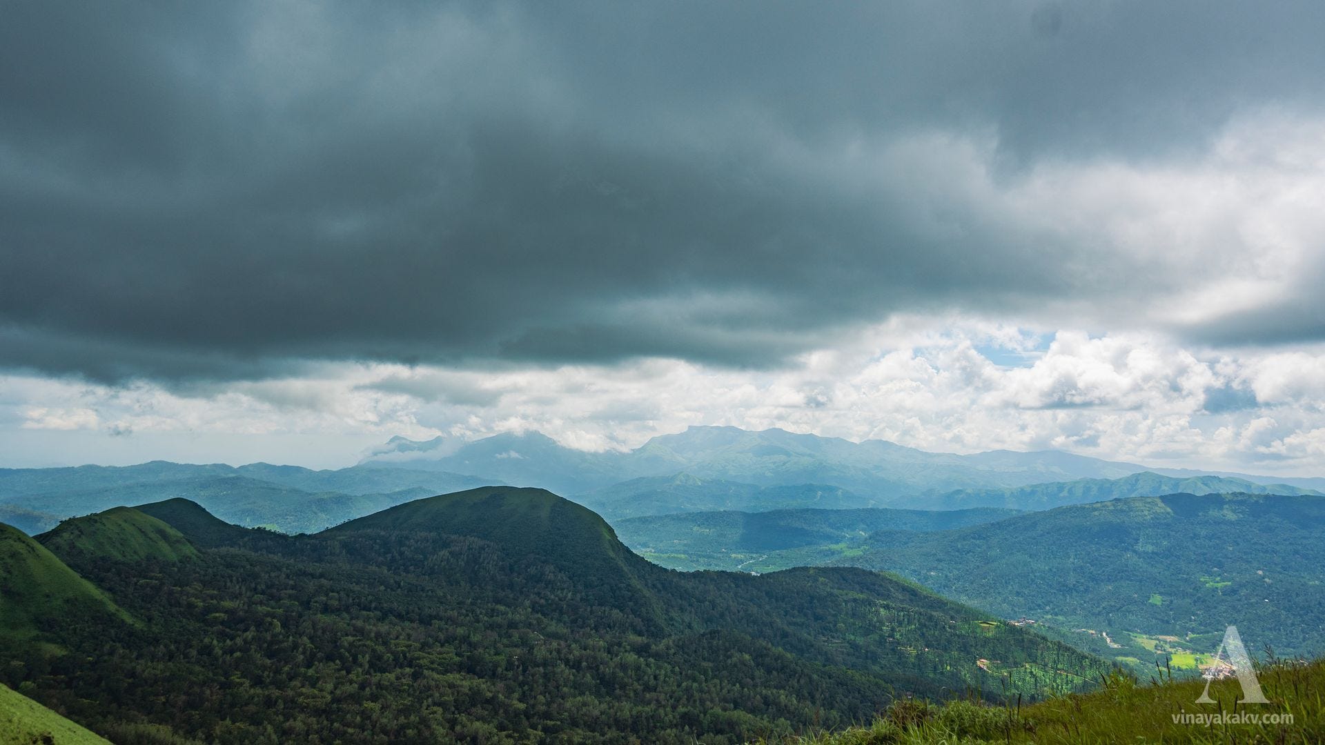
After the Chandradrona and Kuduremukha ranges, there are no contenders in terms of elevation for our “Tall mountain”, making it a good viewpoint of the surrounding areas.
The light and shadow over the shola forest-grassland complex mosic of the mountains of Kuduremukha National Park was beautiful.
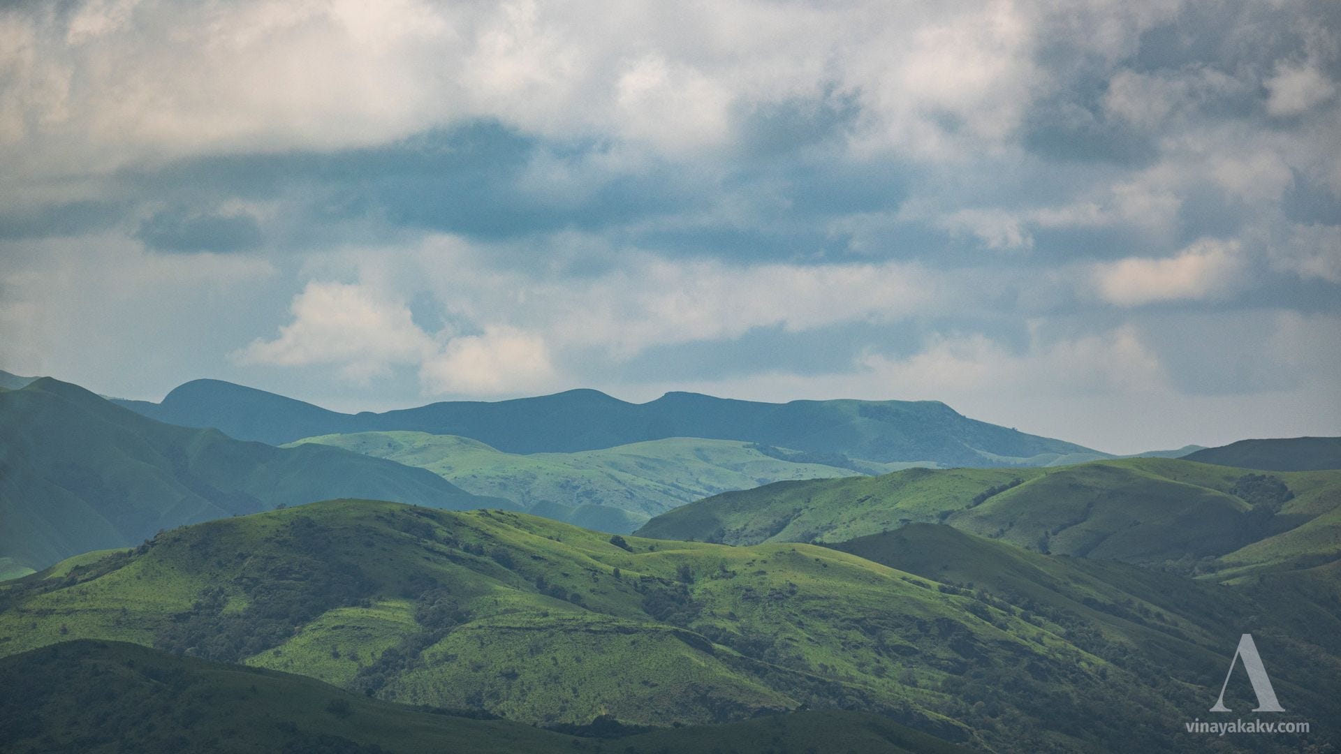
Even when there was no shola complex, the cloud shadows created interesting effects.
Where we were ideally supposed to see the sea (80km-132km), there was haze in the horizon. I wonder if anyone have seen the sea from here, although it does not seem impossible based on the distance.
The richness of the greenery, from grass to the rice fields, makes a feast for the eyes.
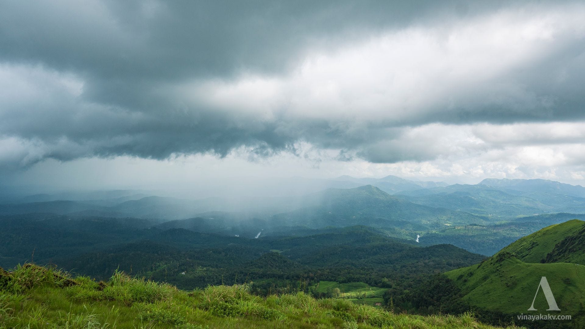
It also rained over some parts of the area, from which we were fortunately spared.
The Life
Life at this elevation surely has a lot of challenges — from torrential rains and winds of monsoon, to the dry winds of winter, and, the manmade fires of summer. However, the life thrives. The grassland, apart from the grasses, is host to a multitude of the plants, including famous Neelkurinji family (Strobilanthes). At the end of the monsoon, most of these plants will be flowering, preparing for the dry season ahead. We managed to capture a lot of beautiful flowers along the way.


Some slopes of the mountain are shielded from winds and host a shola-like forest. Most of the accessible parts of these forests are converted to coffee and tea plantations long ago. Only a few strands of the original forests remain, home to Indian Bisons (Gaur). These bisons often wander into the plantations, sometimes inducing the human-wildlife conflicts.
We (fortunately?) did not spot any bisons. The animal life we saw was a Brahmani Kite suspended in mid air (which I could not take photos of due to camera power running low) and a ladybird.

Bottomline
Seeing a 3.7 Billion year old rock, deformed, folded, now sitting happily at the mountaintop and subject to the weathering, makes the human timescales look miniscule. Yet, as a species, we are affecting these ecosystems in a significant way — either it be causing the loss of biodiversity, encroachment, poisoning the soil while doing agriculture, plastic pollution among other things.
This mountain in a corner of the Western Ghats is not out of the reach of such practices. It is upon us to respect the nature, learn from it, and be a part of it in harmony. In the end, we should not be battling with the nature, we must coexist with it.