

Above the Inversion
Magical sunrise, phenomenal visibility and more!

The tropical winter of 2024 in the Western Ghats of Karnataka is in an on-and-off mode, thanks to the visiting low-pressure areas and the cloudiness and rain associated with them. Due to the rain and strong winds, particulate pollution is kept at bay, though not entirely. Some days remain hazy, with reduced long-range visibility.
Inversion
Haze and winter lead to an interesting phenomenon known as inversion. This occurs when the air mass near the ground is colder than the air mass above, reversing the usual trend of temperature decreasing with altitude. As a result, particulate matter becomes trapped near the ground, leaving the air above it clear.

#/media/File:Thermal_Inversion_in_Urban_Environment.png)
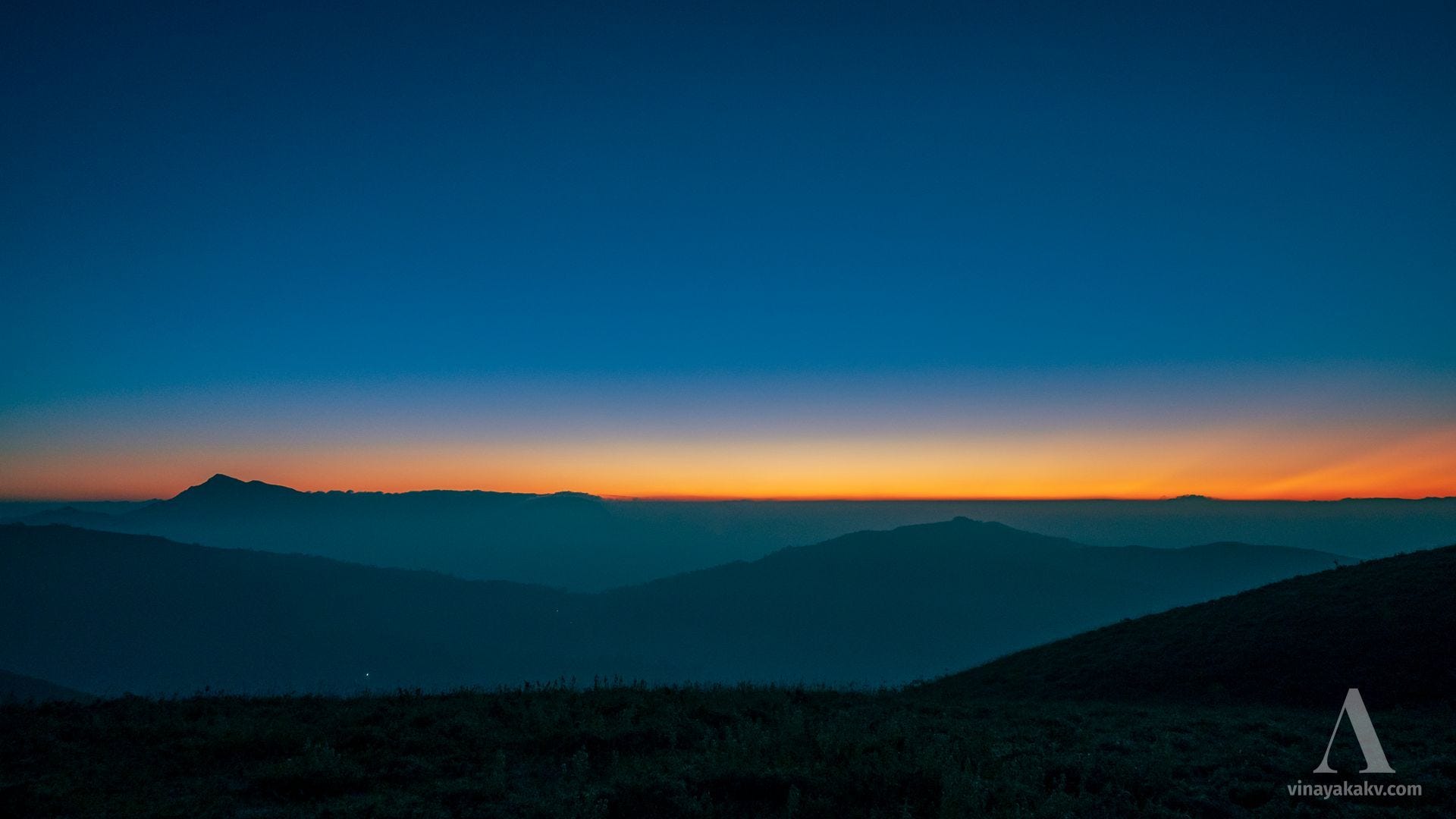
Inversion creates fascinating visuals and can enhance long-range visibility if the inversion layer is low and we are positioned above it. Recently, I found myself on a mountain just above the inversion layer during sunrise, all thanks to a friend who made sure I woke up that early!
The Lucky Morning
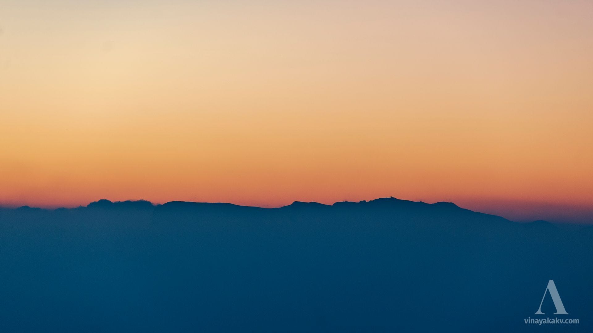
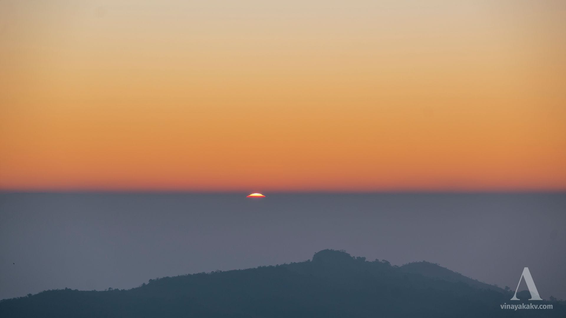
It was an unplanned trip, and we weren’t entirely sure what visuals to expect. I was uncertain whether we would be above or below the inversion line, which could make a significant difference. If we were below the inversion line, we’d have to settle for a hazy view, with much of it obscured by mist. Fortunately, we found ourselves just above the inversion line at around 1300m ASL, and the view was absolutely breathtaking.
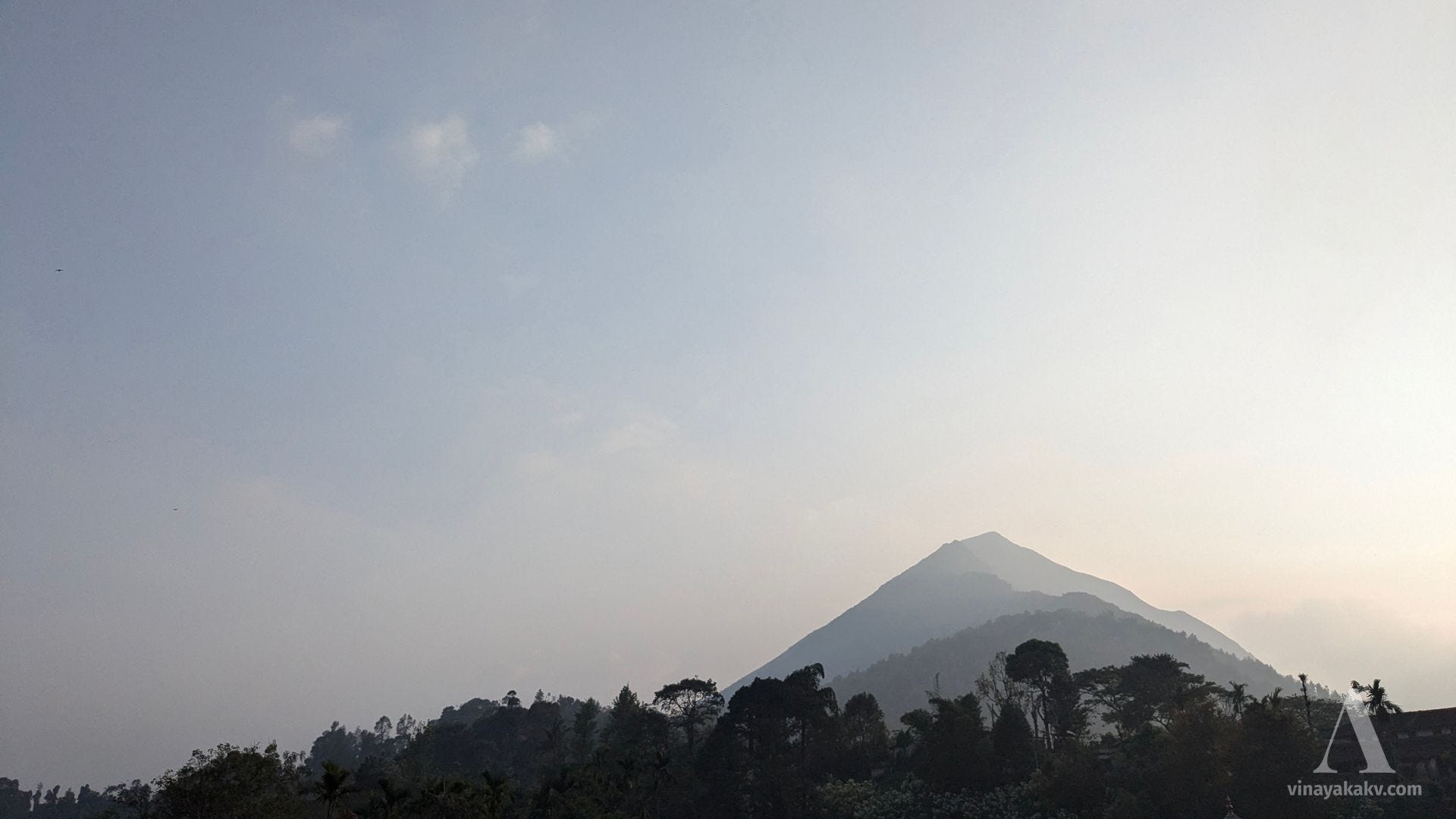
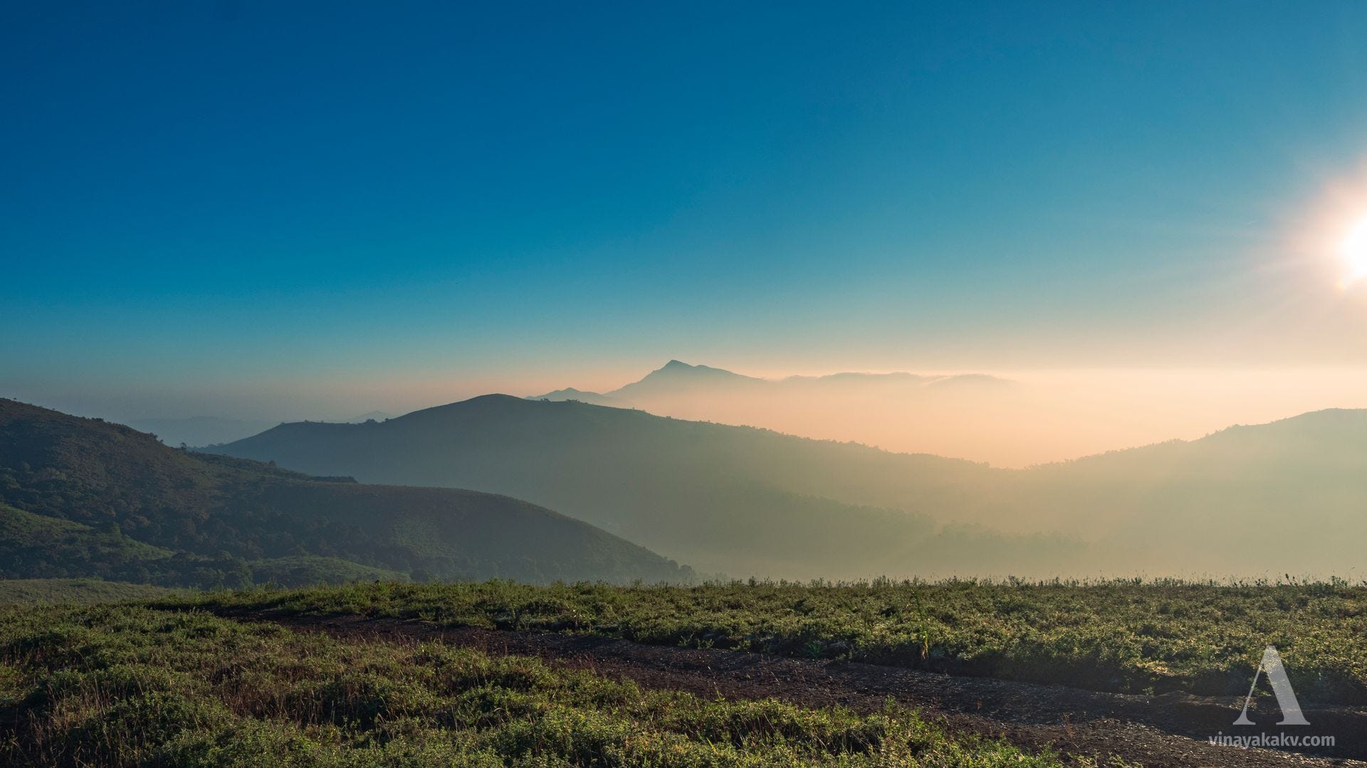
Several prominent mountains rose above the inversion line, with the pyramid-shaped Mertiparvata (~1610m) standing out as a remarkable sight.
Behind Mertiparvata, the towering peaks of Mullayyanagiri (~1930m, the tallest in Karnataka) and Bababudangiri (~1895m) were visible, with the tower on Bababudangiri faintly discernible in the photos.
Looking to the southeast, Ballalarayana Durga (~1509m) stood just above the inversion line, blending seamlessly with it.
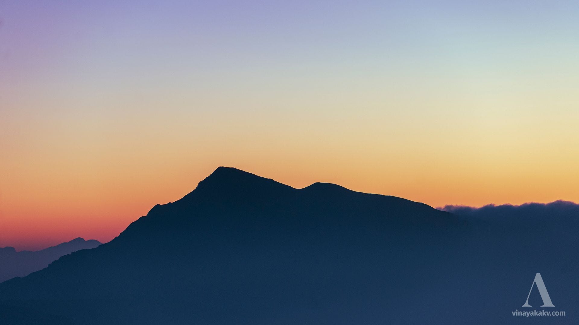
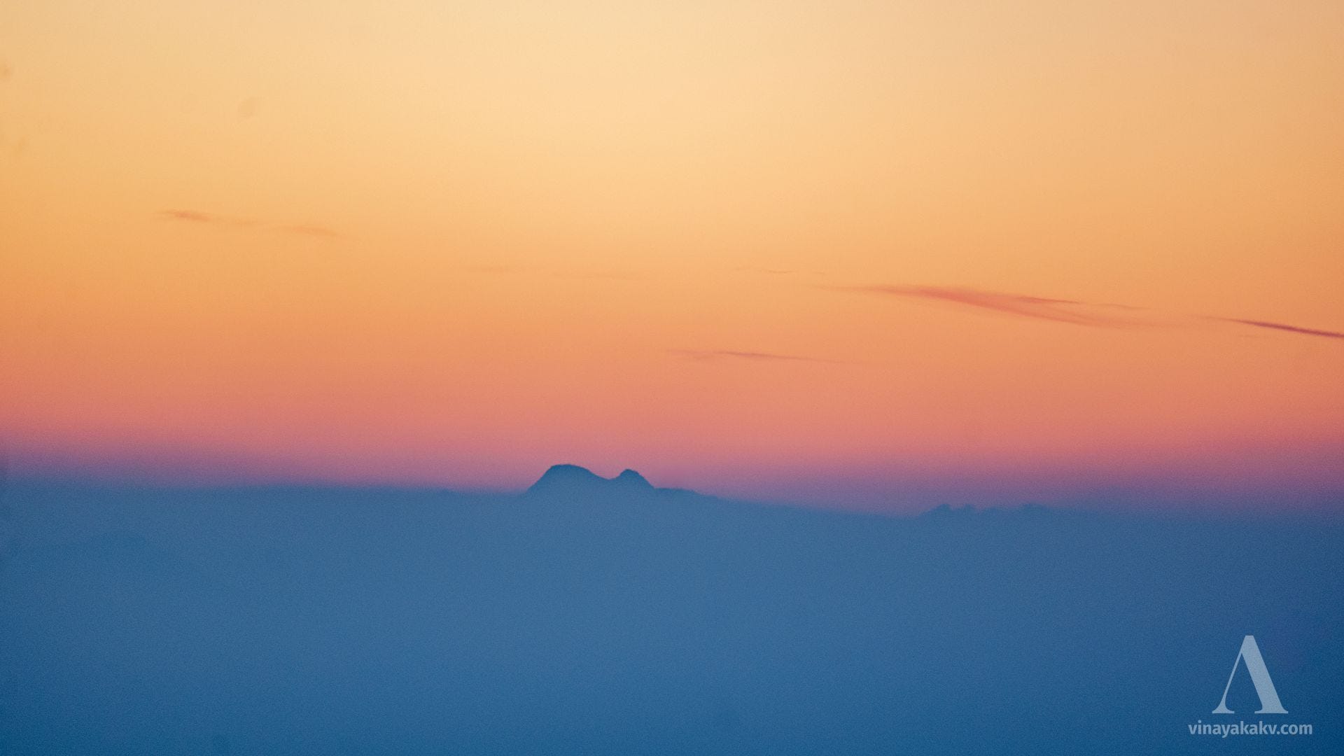
What initially seemed like a disturbance in the inversion line turned out to be the twin rocky peaks of Kumaraparvata (~1712m), located about 80 km away in a direct line of sight. This marks my thirds-highest visibility record, surpassed only by spotting the Nilgiris and Banasura ranges from Mysuru (105km LOS) and sighting Kodachadri from Mangaluru (94km LOS).
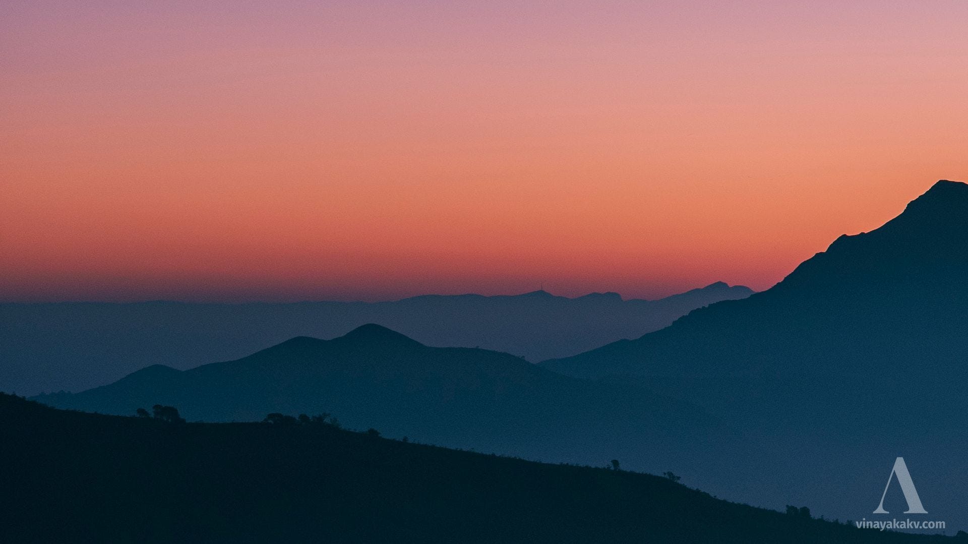
The Kuduremukha range, with its peak at ~1894m, stood gracefully, its sharp summits creating a striking contrast against the morning sky.
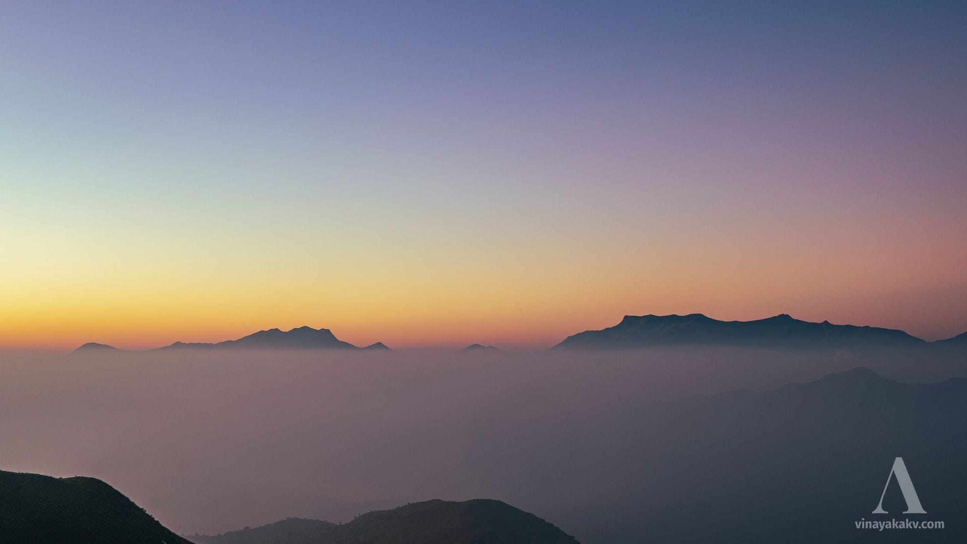
To the east, the shola mountains of Kuduremukha National Park were bathed in a diffused glow of early morning light, creating a mesmerizing and serene view.
Celestial Interruptions
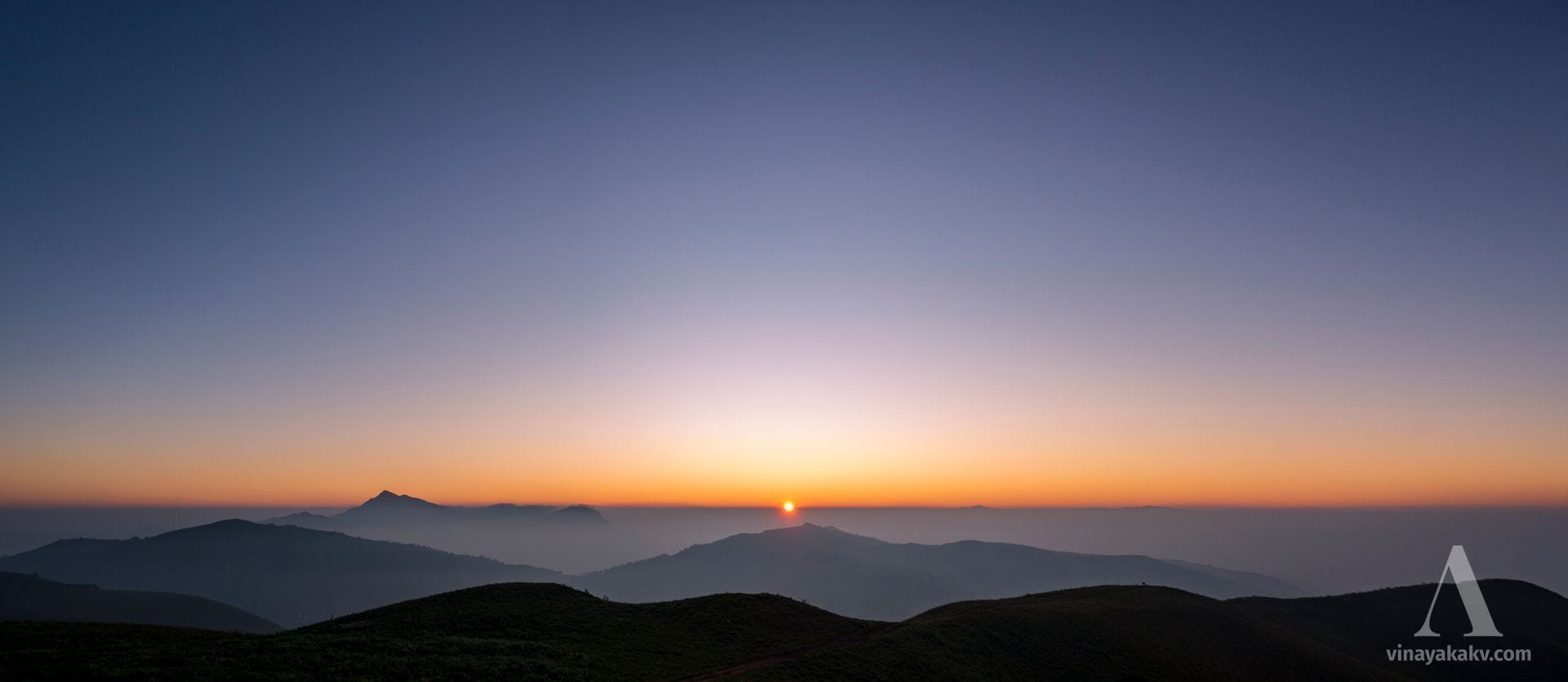
We hadn’t realized that the day we planned our climb was close to a full moon. As we ascended the mountain, we were greeted by the sight of a setting moon in the west, glowing eclipse-red and appearing slightly oval due to atmospheric refraction.
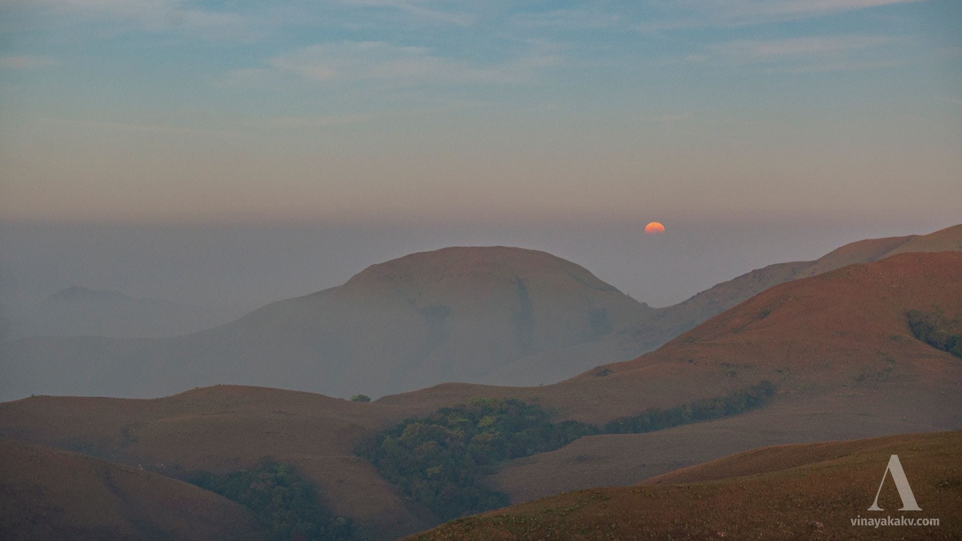
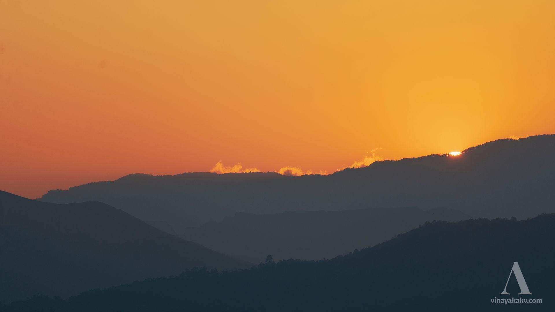
In the east, right on cue as predicted by Peakfinder, the sun emerged from behind the haze line. The sight left all the tourists awestruck, their chatter falling instantly silent. It was truly a moment to behold!
The rising sun with the haze line created a beautiful view as if it was set in dreams.
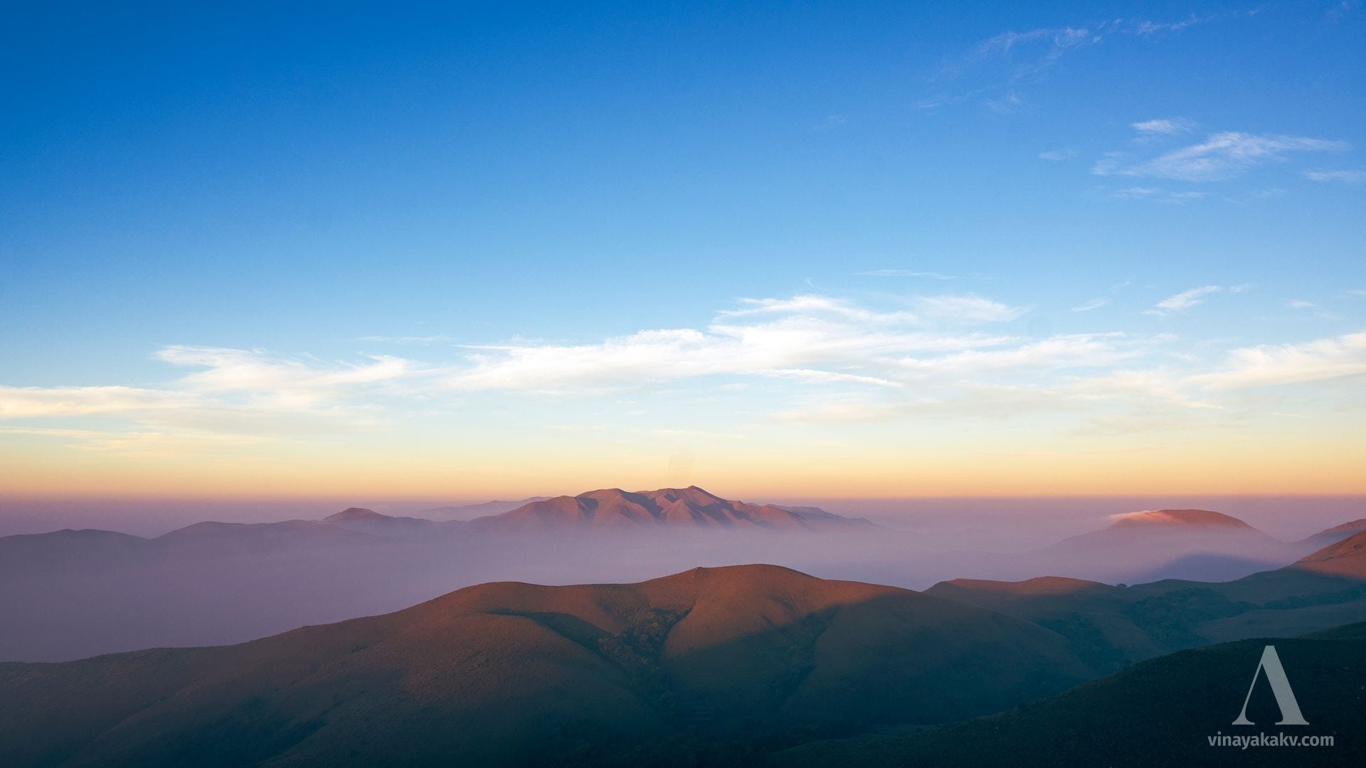
The view did not last long. Soon, the haze line started rising and mist came running up the valleys. Soon, the visibility was decreased.
Until next time
The presence of haze often makes spotting distant mountains a challenge. However, with the right timing and location, inversion layers can help bypass the haze. The beauty of a sunrise, paired with the striking visuals of the haze line, makes sacrificing the comfort of sweet morning sleep truly worthwhile!
On a side note, we were fortunate to witness most of the top ten highest mountains in the Western Ghats of Karnataka: Mullayyanagiri (1st), Bababudangiri (2nd), Kuduremukha (3rd), Kumaraparvata (5th), and Mertiparvata (6th). It truly made for an unforgettable morning!
Really amazing captures and collection of details. Great effort✨