

Story of an Exotic Micro Continent
Mountains, Mountains, and Mountains!

Recently, I had to travel to Mysore from my hometown. Mysore is located in the plains of South India, whereas my hometown is nestled in the mountains. If you know anything about me, you’d know I enjoy traveling in the mountains to keep the homey feeling throughout the route.
You might remember the many times I traveled to Mysore from my hometown, avoiding the boring (though fastest) routes that pass through the plains, and instead choosing to go through the mountain roads, capturing the tallest peaks of Karnataka along the way.
Journey of a Mountain Hunter

Mountains are always beautiful creatures in my eyes. As I am from malĕnāḍu, a hilly and mountainous region of Karnāṭaka in the Western Ghats, my childhood is attached to the memories of numerous mountains. As a child, I was always wondered by changes in the view of mountains from one place to another. When I discovered Google Earth, I was delighted so t…
Across the Mountains

I always love to travel across the mountains for several reasons -- they are beautiful to look at, they host a plethora of flora and fauna, their elevation and valleys give a chance to sight more mountains nearby and far away, and they have long fostered different cultures and belief by isolating groups of people -- all of which I get a chance to observ…
This time, I decided to make a few stops in the mountains of the Kodagu (Coorg) region to explore them more deeply. When I was reading about the geologic processes that created the mountains of Coorg, I came across a research paper that described Coorg as an “exotic Mesoarchean micro-continent”, thus the title of this article.
The Journey
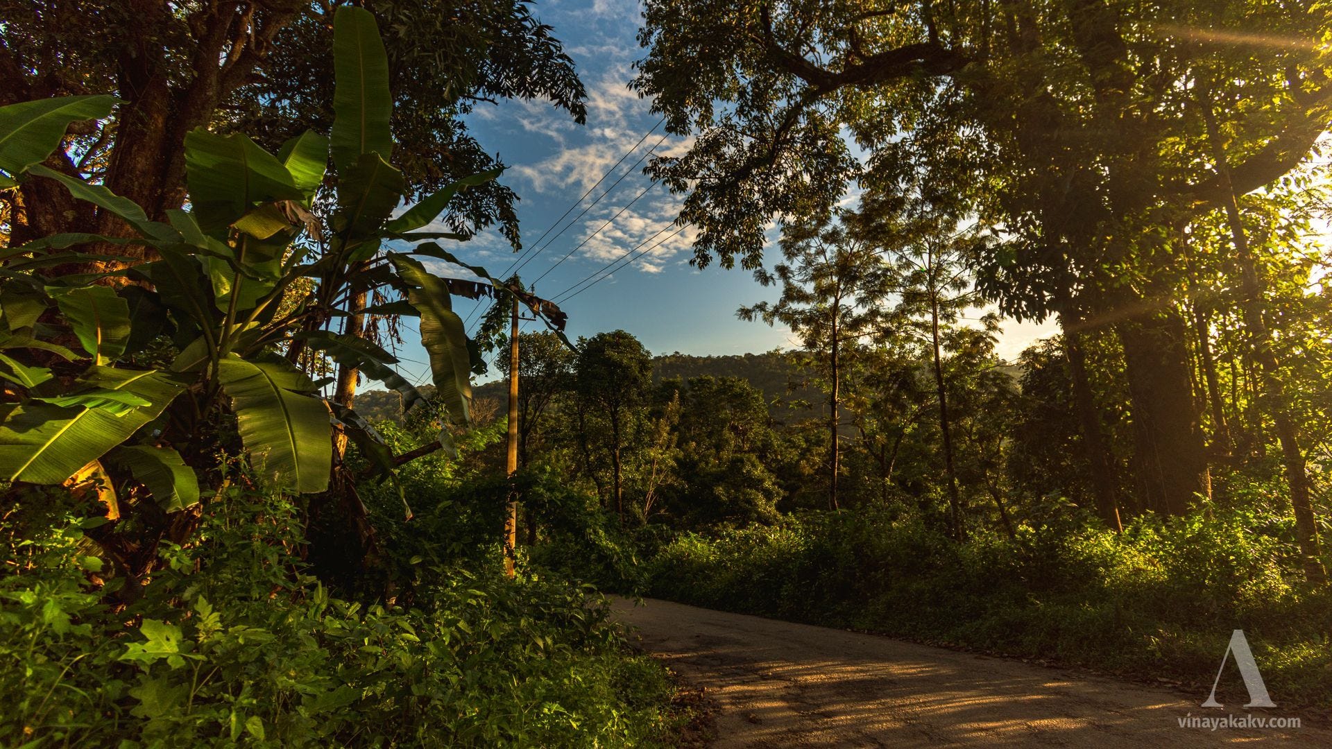
The journey to Kodagu passed through all the familiar routes and mountains mentioned in the earlier articles. I couldn’t take many pictures this time from the bus, as it was hard to get a window seat due to the crowd. However, I did manage to spot the pointed peak of Kumaraparvata (1712m) near Sakleshpur. Remember this mountain — it’s going to take center stage soon!
Due to bus delays, I missed the one that passes through the mountainous regions of Hettur and Mageri to Somawarpet. Check my previous articles for glimpses of that route! This time, I had to make do with the less mountainous road that goes through Shanivarasante. Along the way, we come across the backwaters of the Gorur Dam, built across the Hemavati River (I’ve written an article about the mountains where this river originates—go check it out!).
As we approach Somawarpete, smaller mountain ranges began to rise gradually in elevation. When I reached Somawarapete, it became cloudy and dark, so I had to stop taking photographs, hoping for pleasant weather the next day.
Unfortunately, I accidentally lost all the photos from that day. So, please check out the earlier articles for some visual delights!
The Fort Mountain
Many hills and mountains were historically fortified. These forts were later dismantled as administration became centralized and preventing rebels from using them as bases became important. Our particular destination was a fort mountain called Kotebetta, which stands at an elevation of 1635m, though no visible remains of a fort exist today. Near its base lies a temple dedicated to the god Shiva, which was our destination. There is another temple dedicated to Shiva at the top of the mountain, which I explored in a previous article. Unfortunately, I couldn’t plan a hike this time due to time constraints.
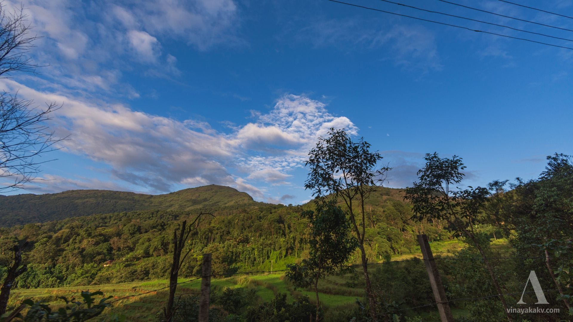
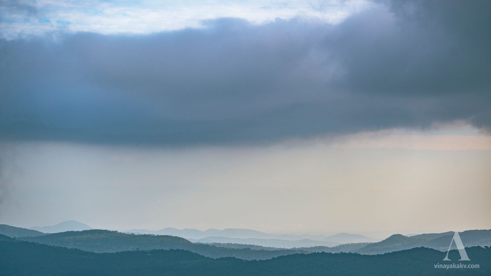
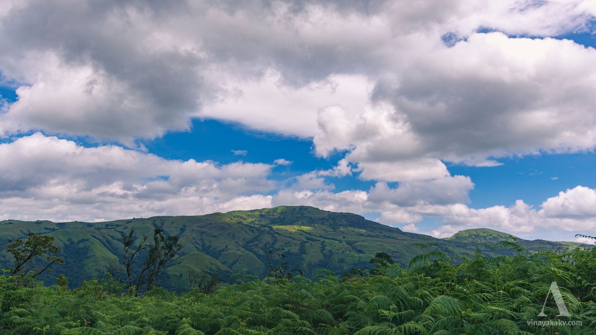
We had a good start to the day with blue skies, scattered clouds, and pleasant sunshine illuminating the coffee plantations.
The view of the mountain looked promising as well, clear and free of clouds.
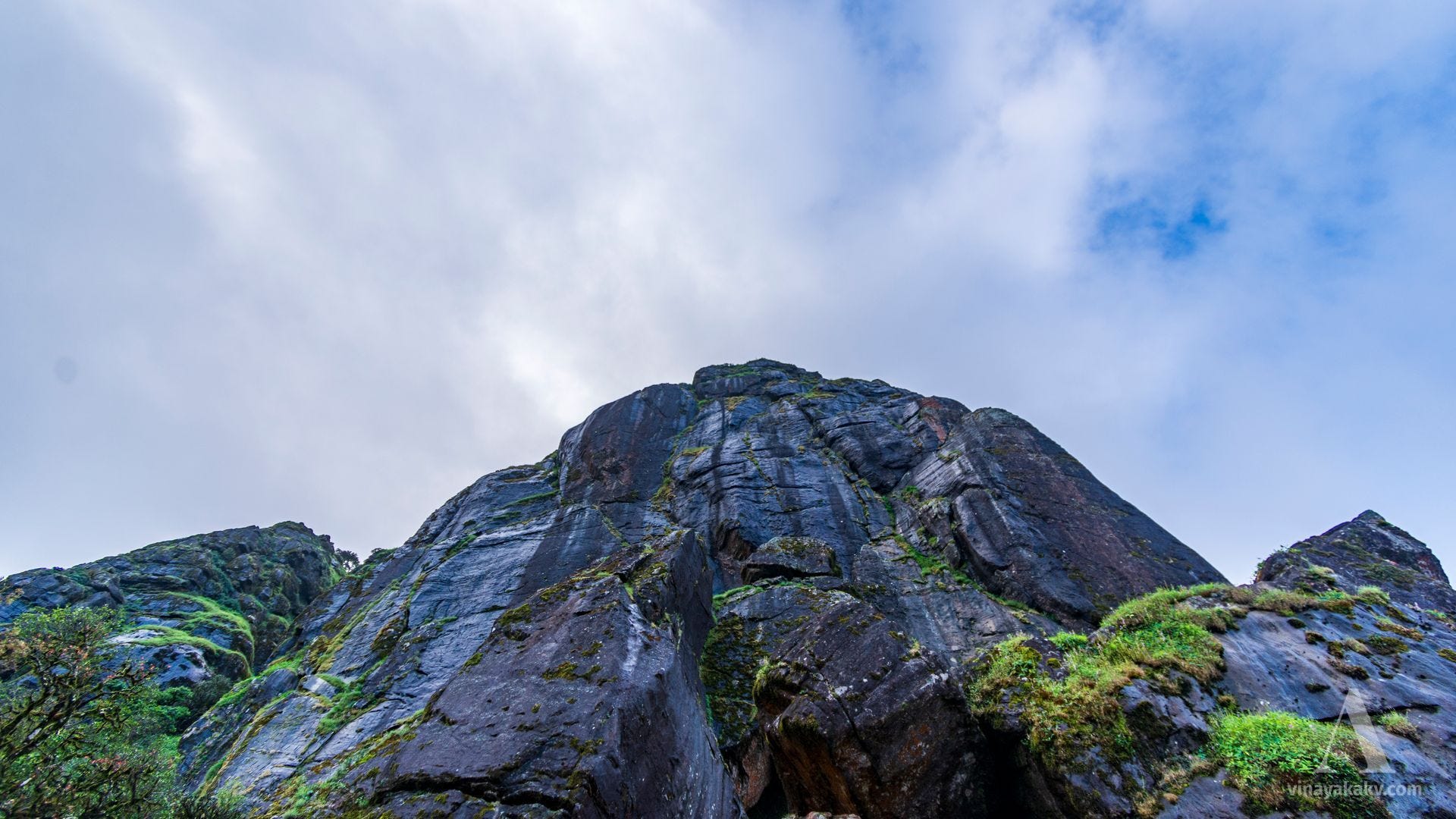
As we gained elevation and reached near the base of the mountain, we had a superb view of the rocky mountain, with sunlight highlighting the water-stained rocks.
This mountain’s base consists of exposed rock, which is slowly eroding over geologic time, forming cracks and breaking away smaller boulders. The scale of these exposed rock faces is gigantic.
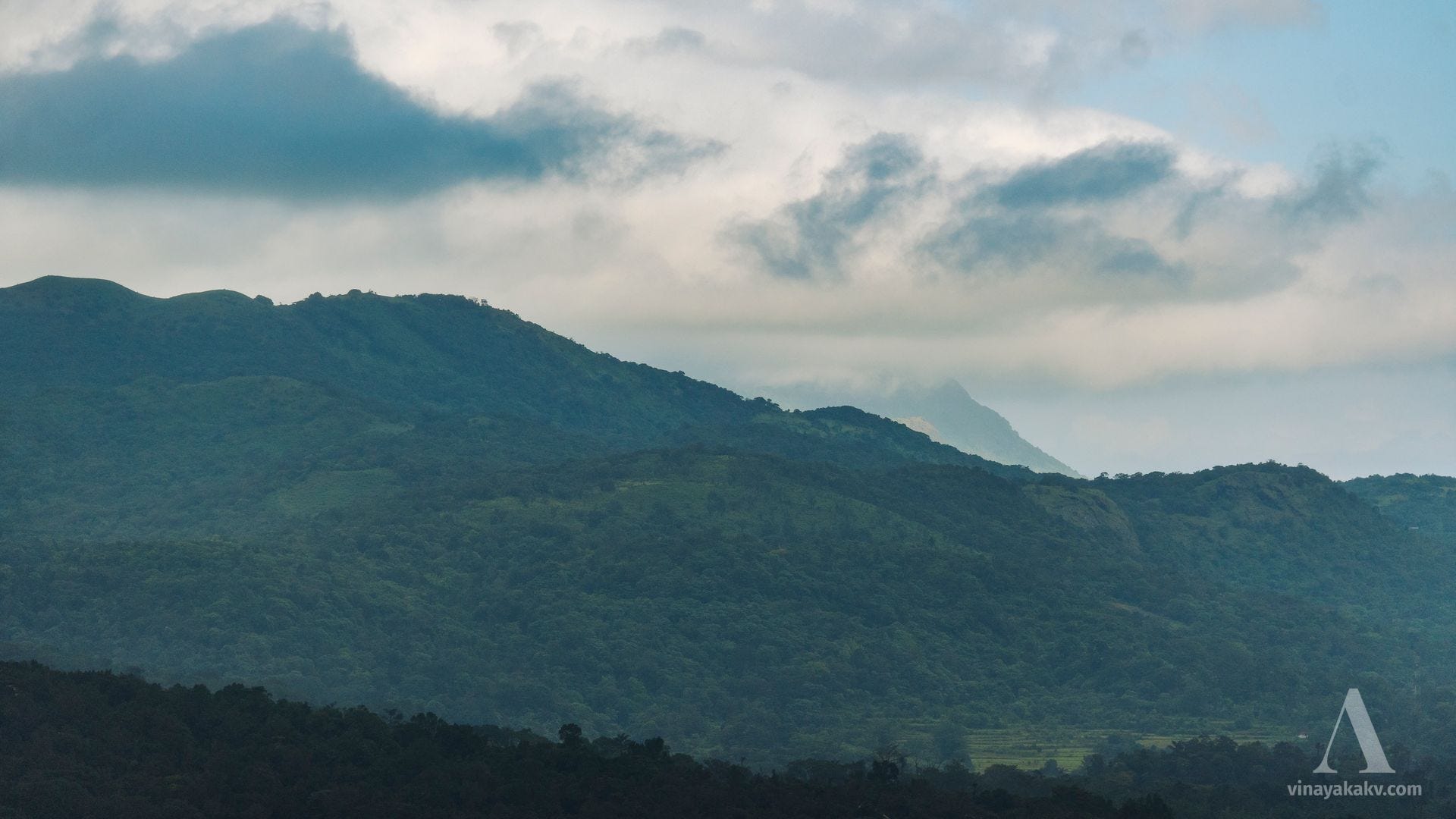
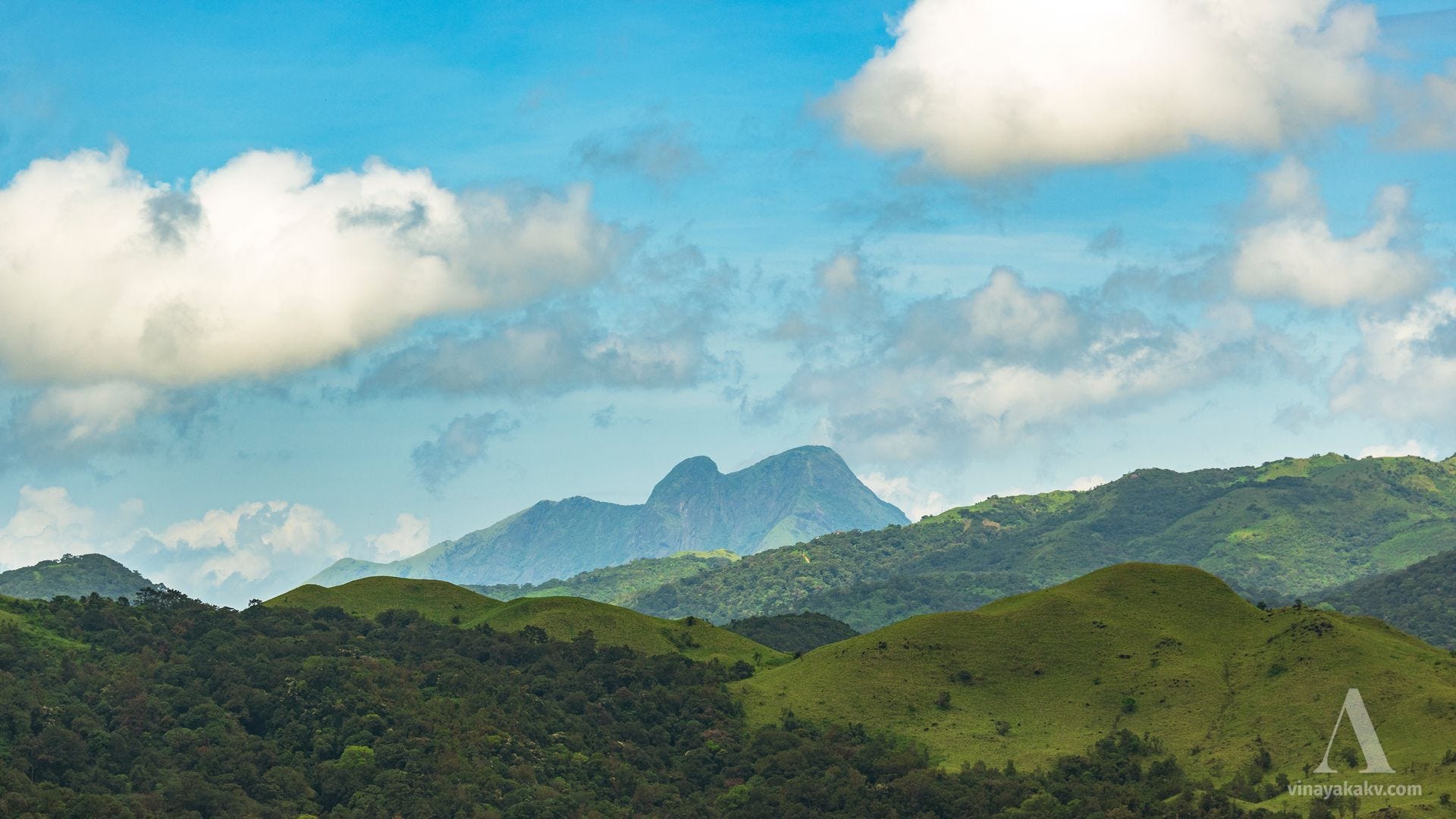
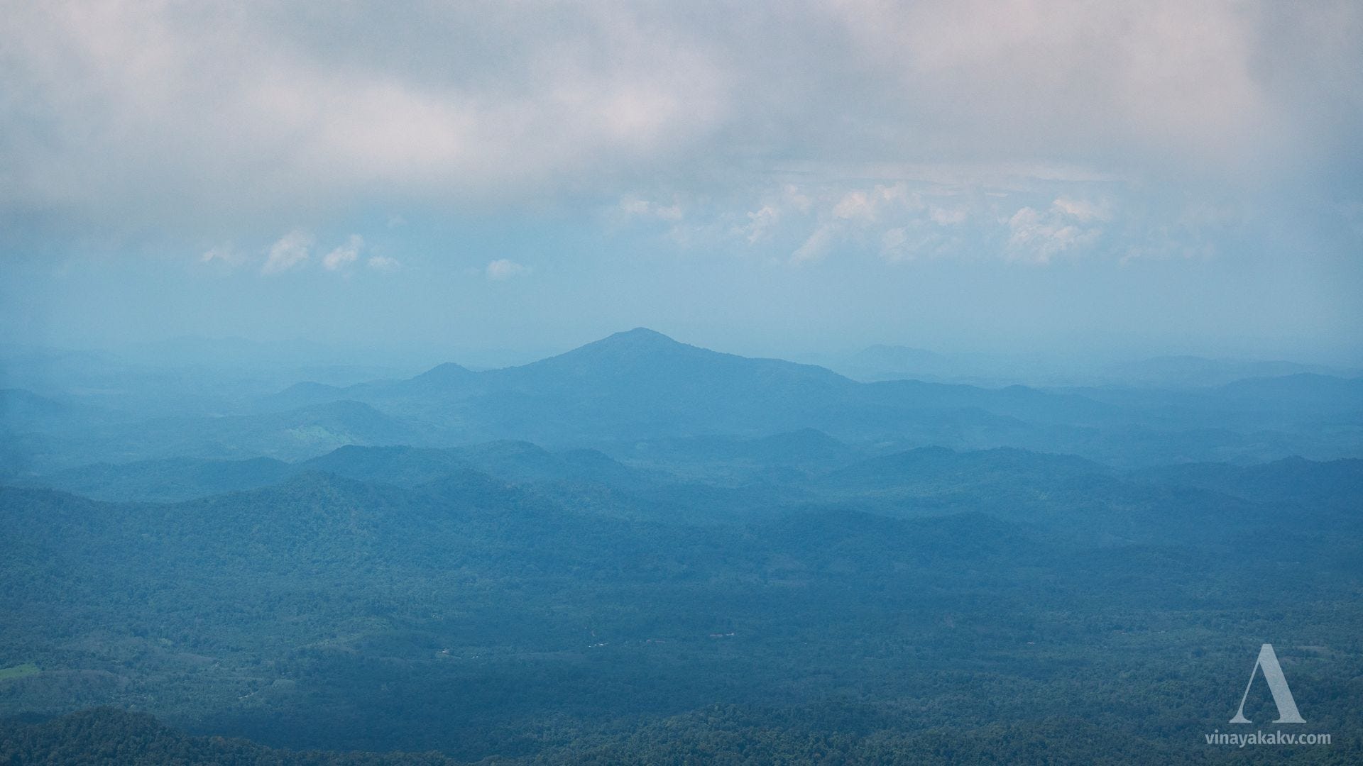
From near the base of the rock, we could get a good view of the surrounding mountains. Although I had high expectations for the visibility range, I had to settle for reduced visibility due to the clouds. However, the combination of clouds and the morning sun created beautiful views.


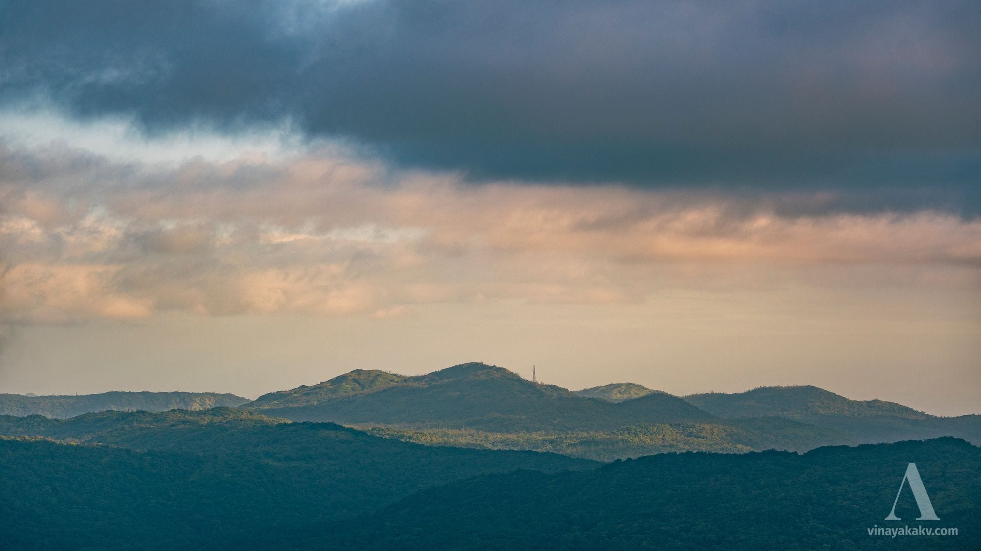
Soon, clouds began rolling over the mountain, and a light drizzle started. Wherever sunlight still broke through, it was a perfect moment to capture the mountains. The smaller ranges near Shanivarasante, which I mentioned earlier — with the prominent peak of Malambi (1354m) — stood out beautifully amid the drifting clouds.
We could see a few distant hills marking the border of the plains. Under ideal visibility conditions, the view would extend much farther, encompassing the plains as well.
The farthest peak I could identify was Bantamale (731m) near Sullya, located in the coastal plains. The visibility of that mountain wasn’t very good either.
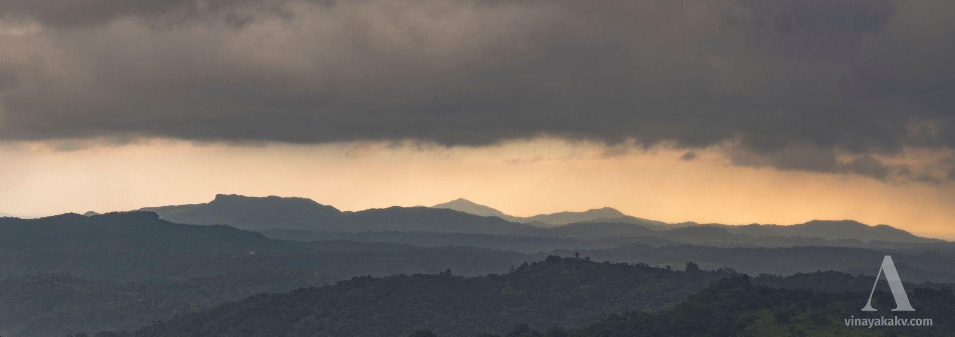
Ideally, we would be able to see the rocky summit of Kumaraparvata from this mountain, but it was covered in clouds, making it difficult to identify.
However, we could spot the Surlabbi waterfall, which was running low on water and had been unrecognizable when I visited this mountain during the dry summer.


Soon, the rain began to intensify, and the clouds started to obscure the view, forcing us to leave.
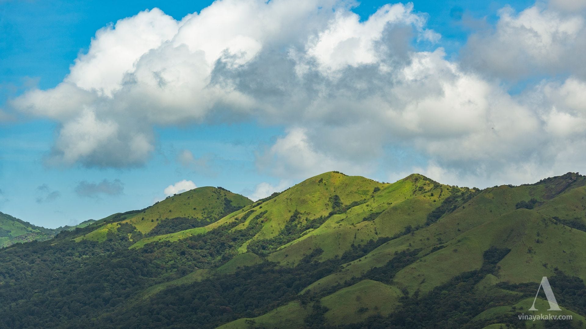
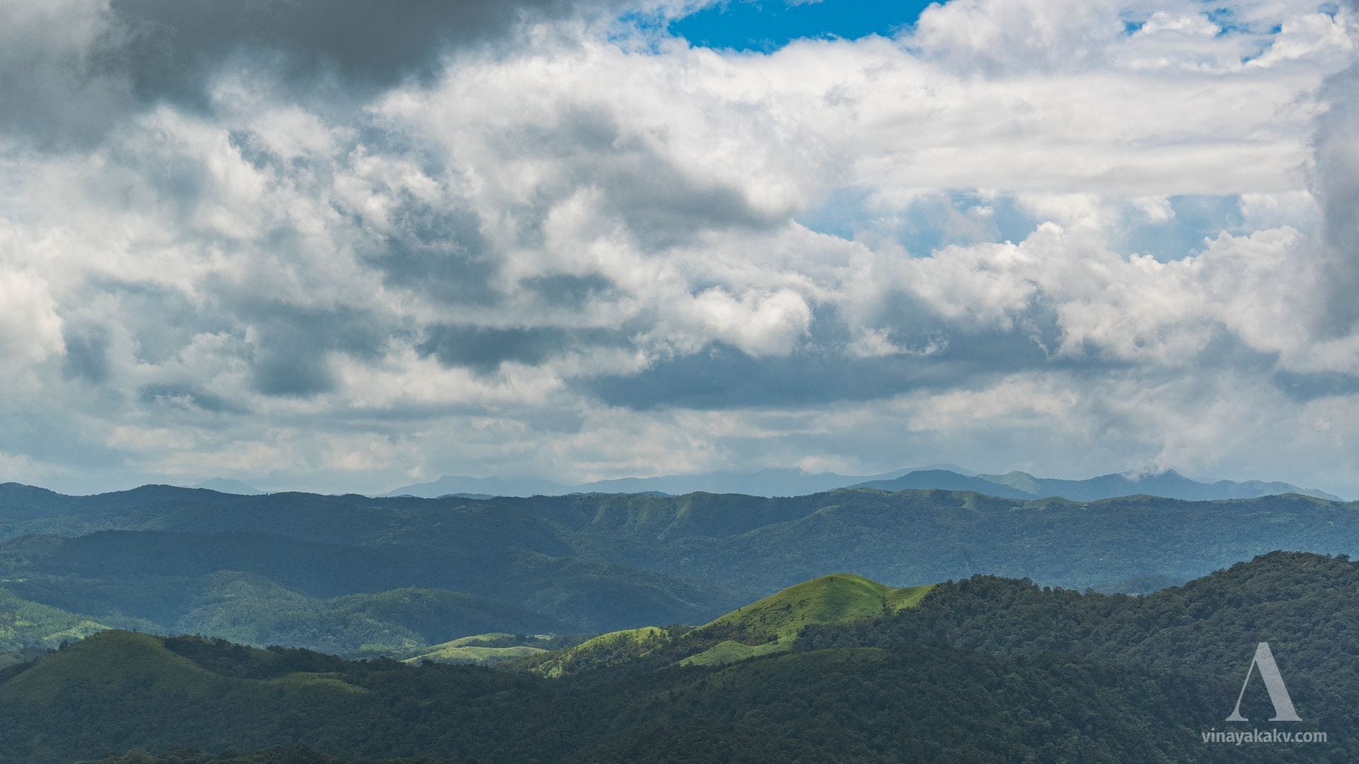
The Shola Ranges
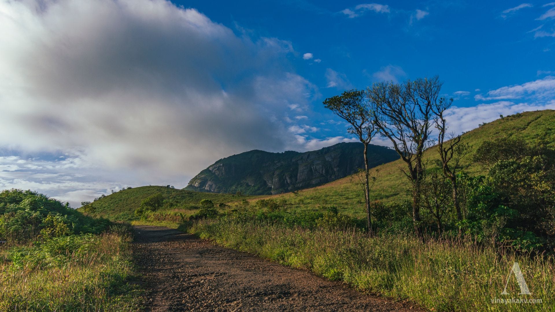
Later in the day, as the sun finally returned to duty, we headed toward another mountain located on the edge of the Western Ghats. The place, known as Mandalapatti, is popular among tourists visiting Coorg. As we began our journey from the deep valley near Kotebetta, we started spotting grass-covered mountains along the way.


Soon, Kotebetta revealed itself in all its vastness.
Kumaraparvata was not far behind either, beginning to peek out from behind the other mountains along the way.
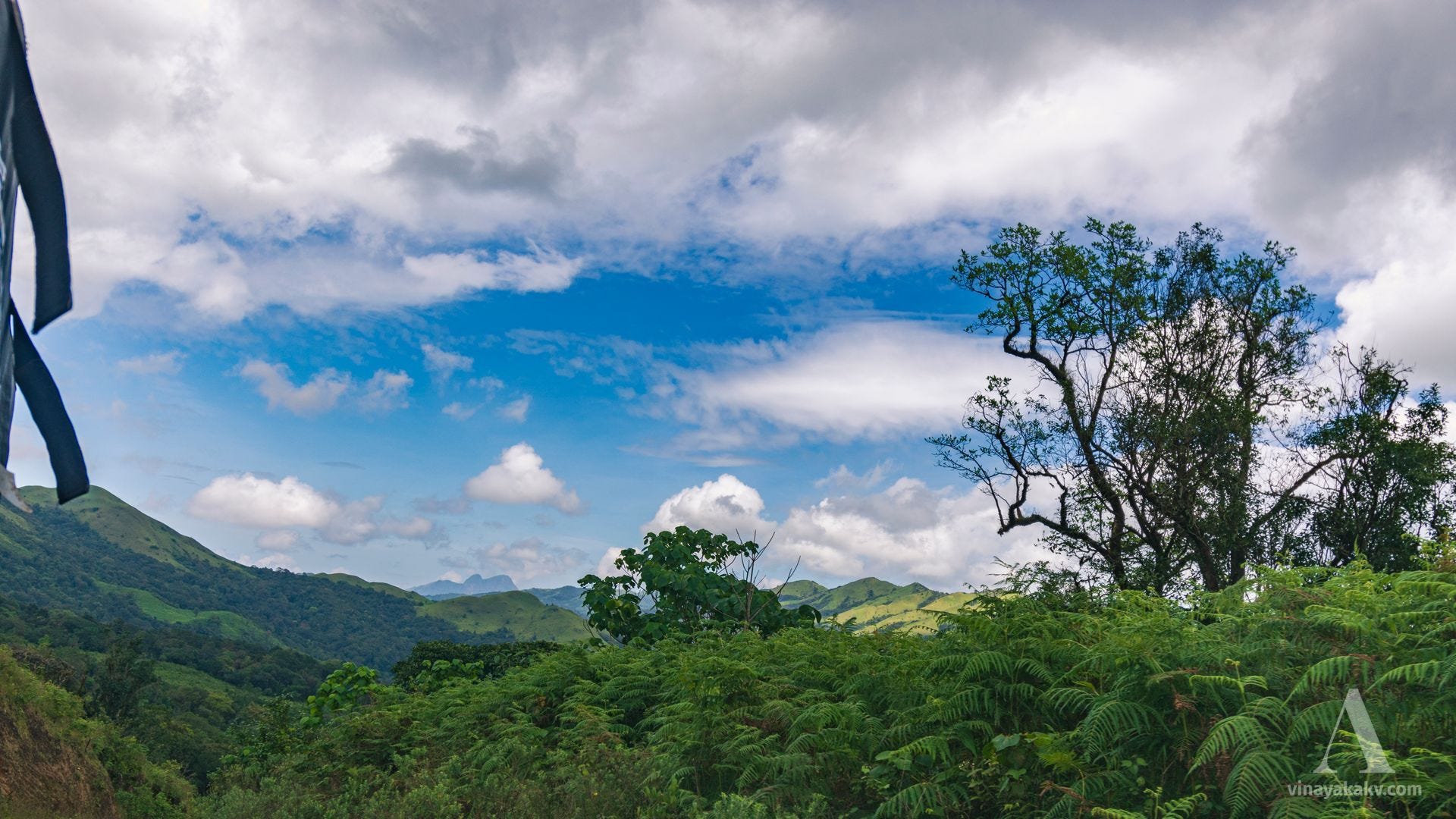
Soon, it was time for Kumaraparvata to reveal itself — at least a little more than just its peaks.
There were many named and unnamed shola mountains, all lush green and covered in a mosaic of light and shadow created by the passing clouds.
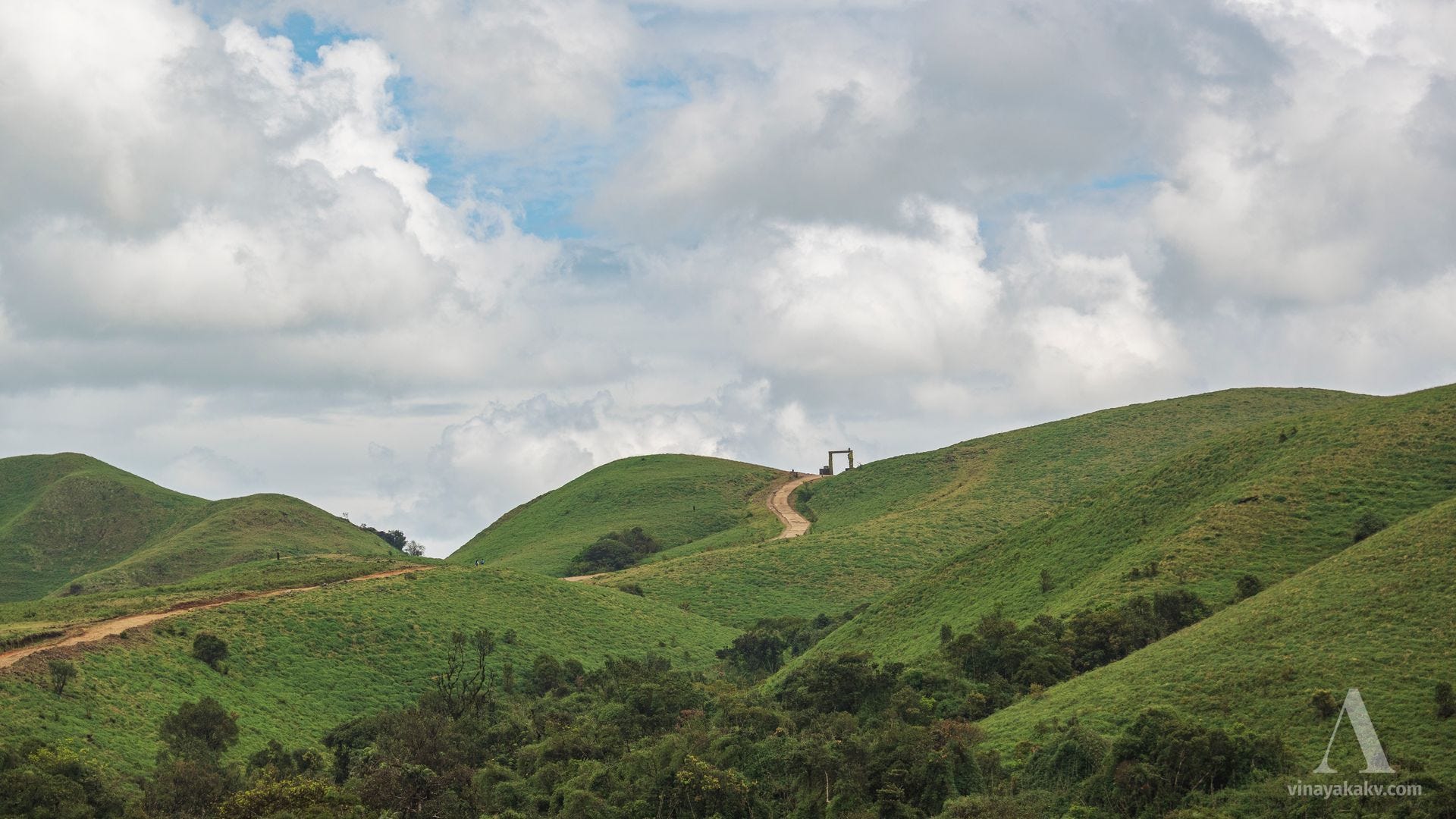
The forest department has put up a (useless?) gate in the middle of the wilderness to signify that we’re close to the final viewpoint!
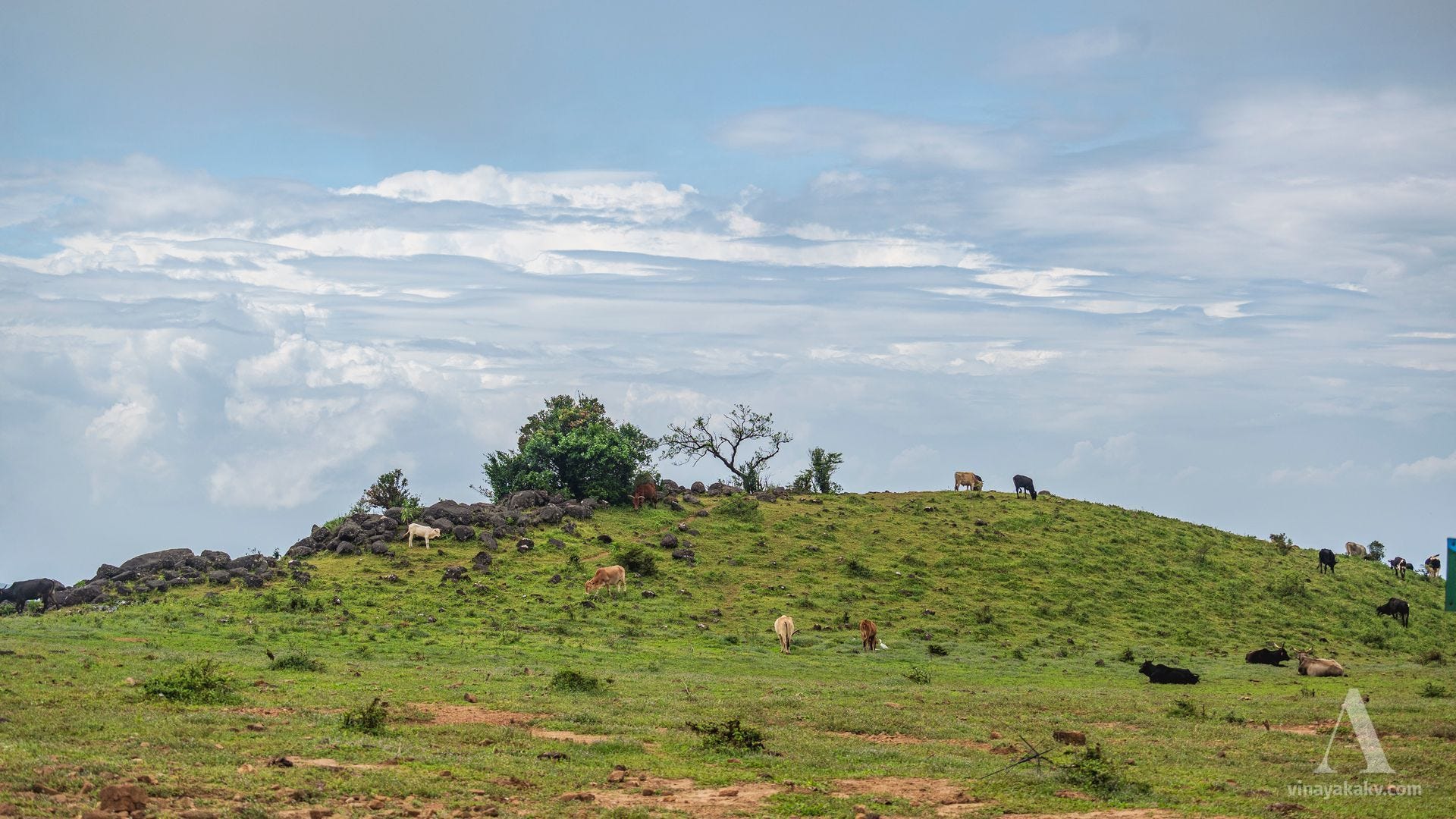
At the viewpoint, we were greeted by a lazily grazing herd of cattle. The place truly lives up to one of its names I found in a map, “mandal-hatti,” meaning “a grazing place for cattle”!
Views and the Scars
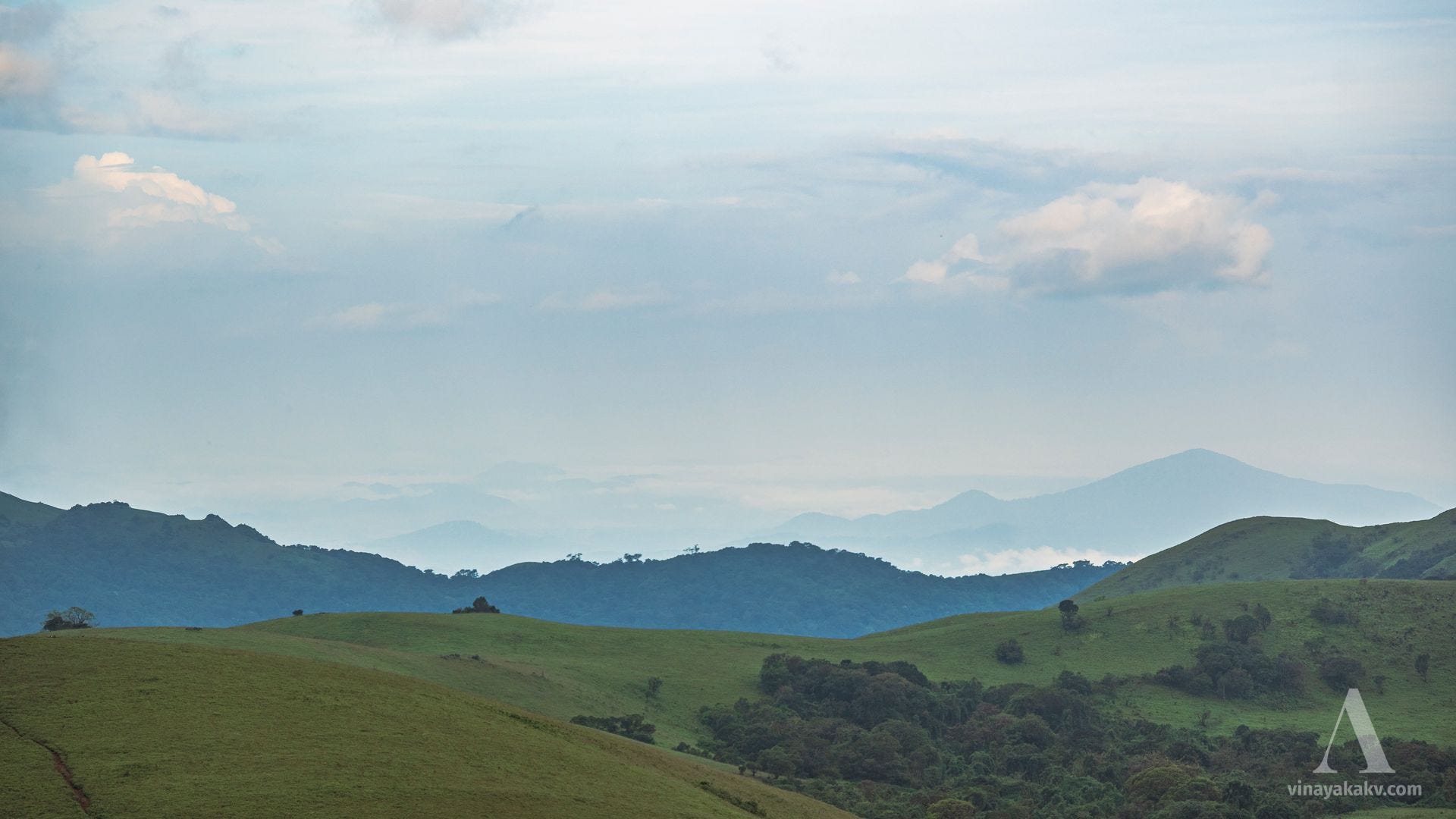
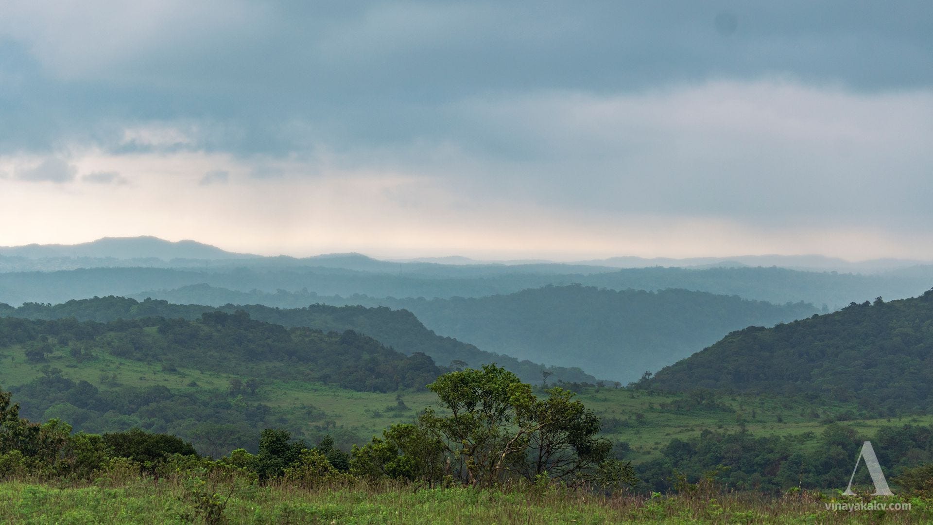
The viewpoint at Mandalapatti offers a stunning view of the coastal plains and the surrounding mountains. The previously seen Bantamale of Sullia draws attention as it rises prominently above the coastal landscape.
We could see the steep, densely forested slopes of the mountains descending toward the coast. These slopes are marked by scars from the landslides that occurred in 2018 and 2020 due to heavy rains.


Apart from the steep slopes, we could also see parallel ranges with peaks peeking out from behind them. Since the day was cloudy, we couldn’t spot or identify many mountains. I had hoped to catch a clear view of the Kuduremukh Range about 90 km away, but that still remains a distant dream!
To the Plains
Since I had to continue toward my actual destination, I couldn’t stay in the mountains forever. As a final stop, I stayed at a friend’s place (if you’re interested in travel, history, and folklore within and beyond the mountains, you should definitely check out her blog!) and decided to visit a nearby mountain that offers a great view of the town of Virajpete and the surrounding peaks.


The journey to the plains took me through the Nagarahole Reserve Forest, which was lush and green thanks to the recent monsoon rains (it usually dries up during the summer). Unfortunately, I couldn’t take any pictures along the way due to the crowded bus — same story as at the start!
Return Journey
During the return journey, I couldn’t explore more mountains, as Cyclone Motha brought drizzling weather across the Western Ghats region of Karnataka. I took a route through the plains instead of the mountains.
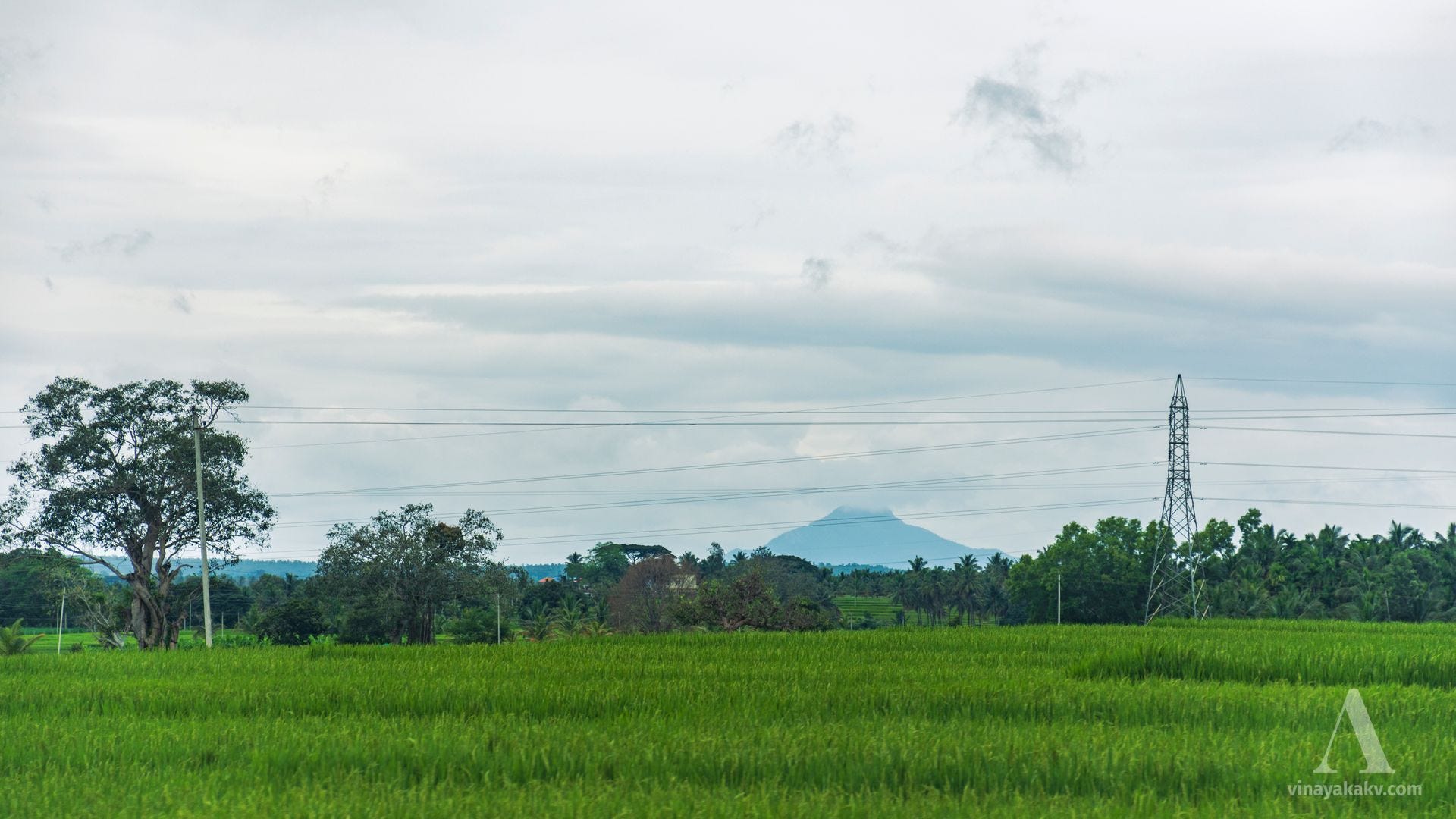
Due to the clearing of pollution by the cyclone’s winds, I was able to spot the Nilgiris from the outskirts of Mysore, something I had managed to do once before. Unfortunately, I couldn’t capture a photo of it this time.
From Mahishasura to Banasura

Almost every mountain and hill touched by Indian civilization has a mythical story associated with it. Most of the time, these stories helped conserve local biodiversity by making the mountains sacred. However, in some cases, the worship of these mountains has gone to extremes, with the stories of gods taking precedence over the original intent of conse…
The prominent mountain visible across the plains was Bettadapura Hill (1318m), located just outside the core Western Ghats range. This mountain accompanied me for a good part of the journey.
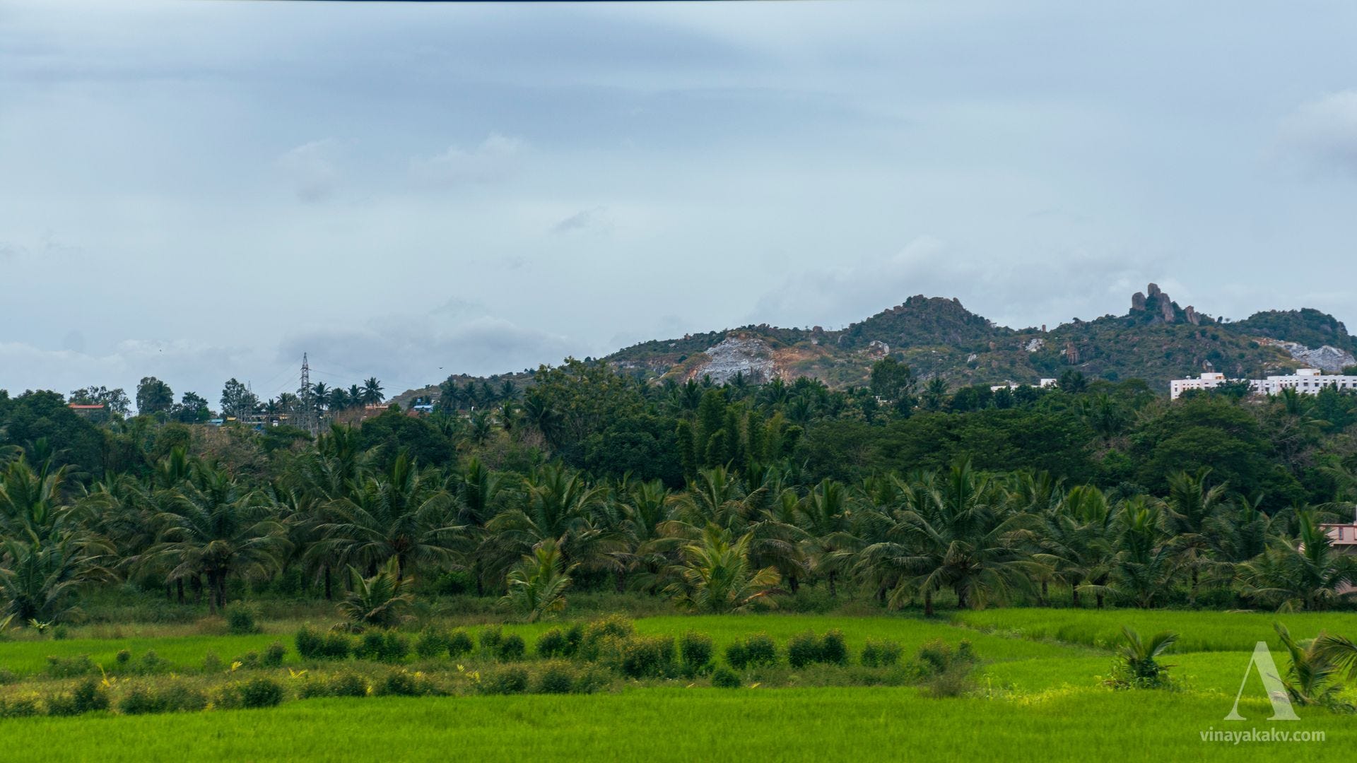
Apart from that, there are no significant mountains in the plains, only numerous granite hillocks scattered across the landscape.
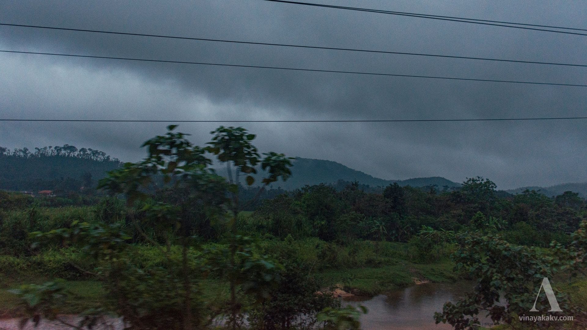
When I re-entered the Western Ghats, I was greeted by rainfall and nightfall at the same time.
Until Next Time
The Western Ghats, though not as grand in elevation or terrain as the Himalayas or other Alpine ranges, are incredibly diverse. The geographic barriers they create have led to a rich cultural variety that can be experienced in the region’s cuisine, languages, traditions, and customs. Beyond the human elements, the serenity of the mountains themselves is truly captivating.
After spending so much time living and traveling in the mountains, I felt a kind of jet lag when I returned to the plains of Mysore. I only recovered once I made it back home. Truly, the mountains have a way of capturing both the heart and soul!