

The Electric Mountains
The Electric Transmission towers appears on top of those mountains. But what else is there? Let's find out!

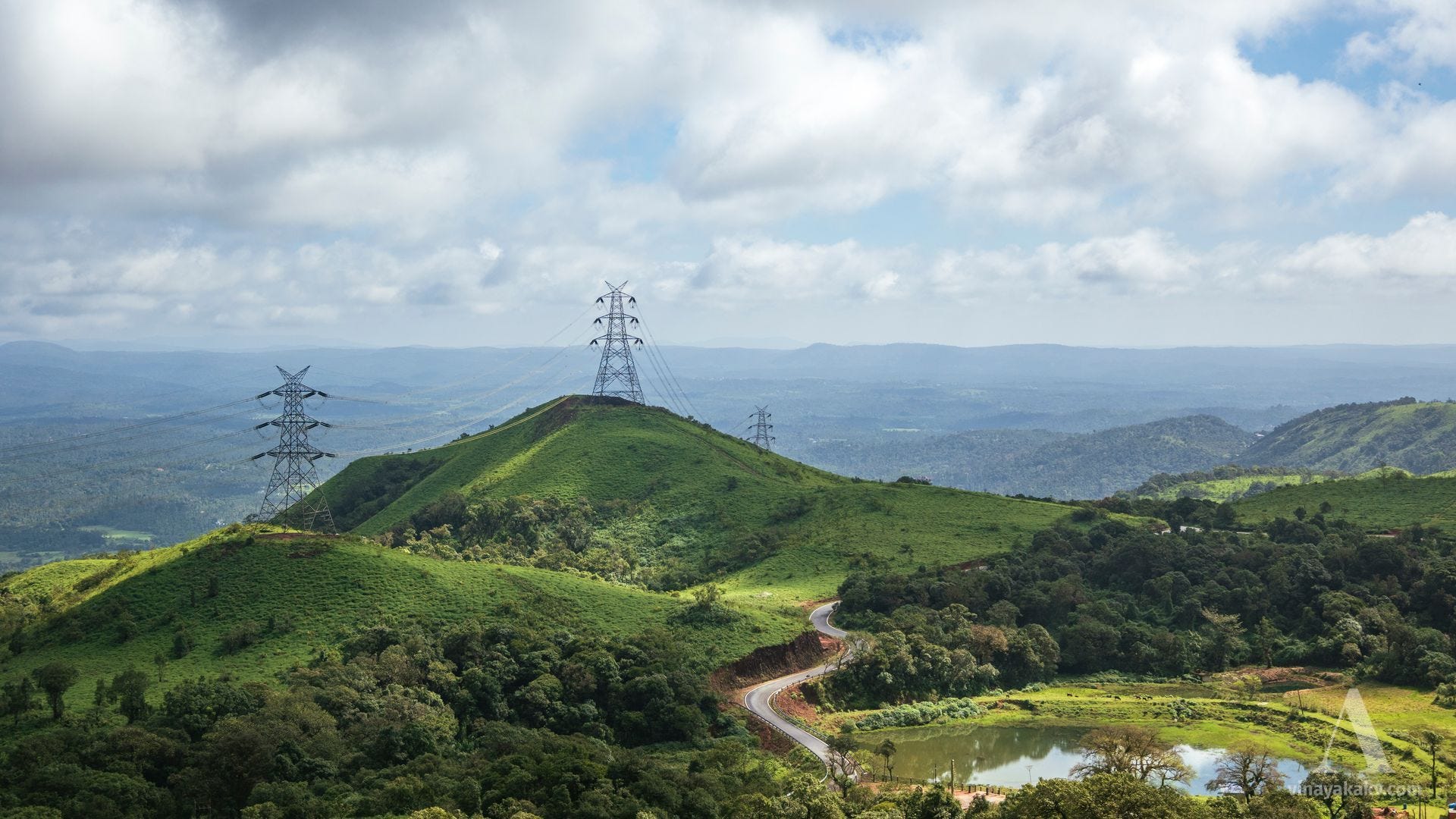
For anyone traveling from Mudigere of Chikkamagalur towards Mangalore, a line of mountains with transmission towers immediately draws attention, with the imposing towers adding significant height to these peaks.
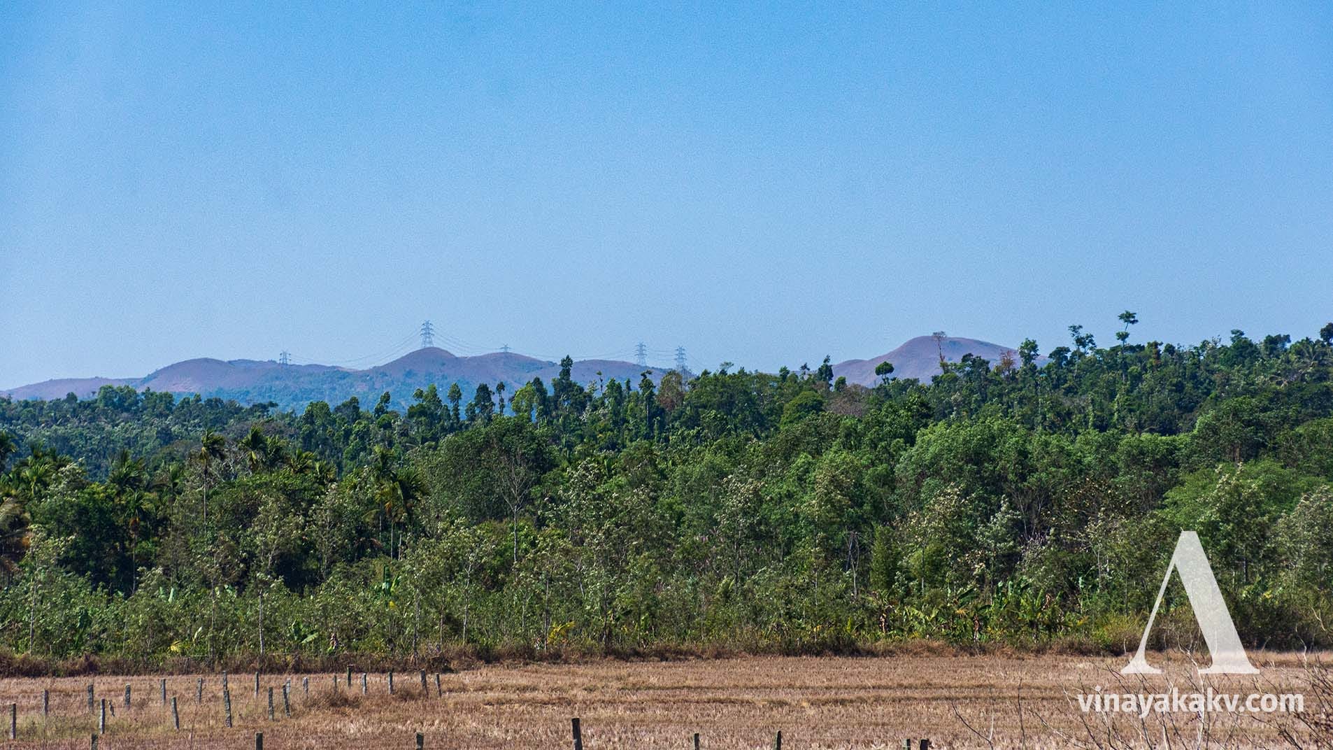
At the beginning of the Charmadi Ghat, these mountains are fully visible, from base to summit, with the transmission towers now appearing to contribute very little to their overall elevation.


Though I had seen these mountains every time I traveled to Mudigere and Charmadi, I had never visited them. Recently, when I needed to travel to Mudigere, I decided to take a detour with a friend and explore the hills.
The Weather
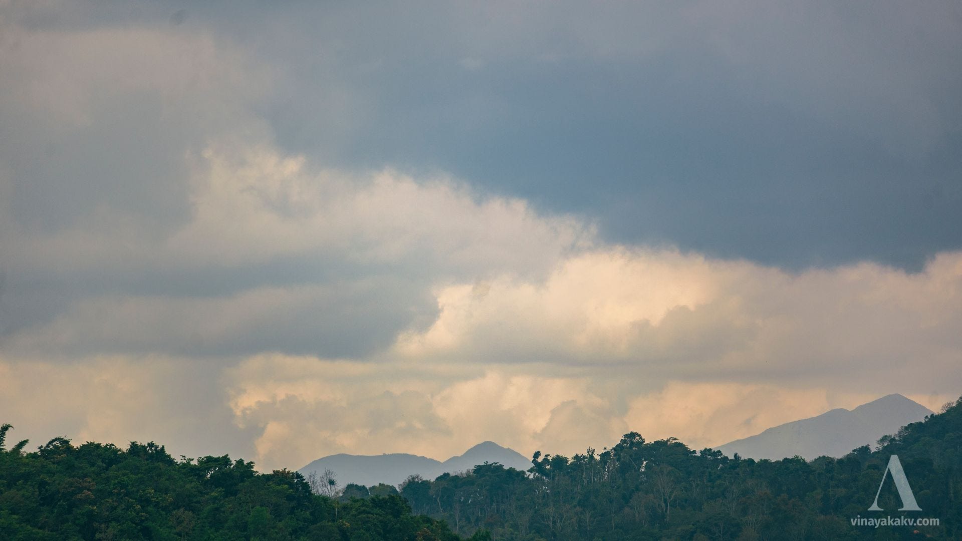
It was the period when the bountiful Southwest Monsoon of 2024 had just ended, and the southwesterly winds had subsided. The previous day’s rain had completely cleared by nightfall, allowing me to glimpse the Milky Way — perfect weather conditions for mountain hunting!

Mountains En Route
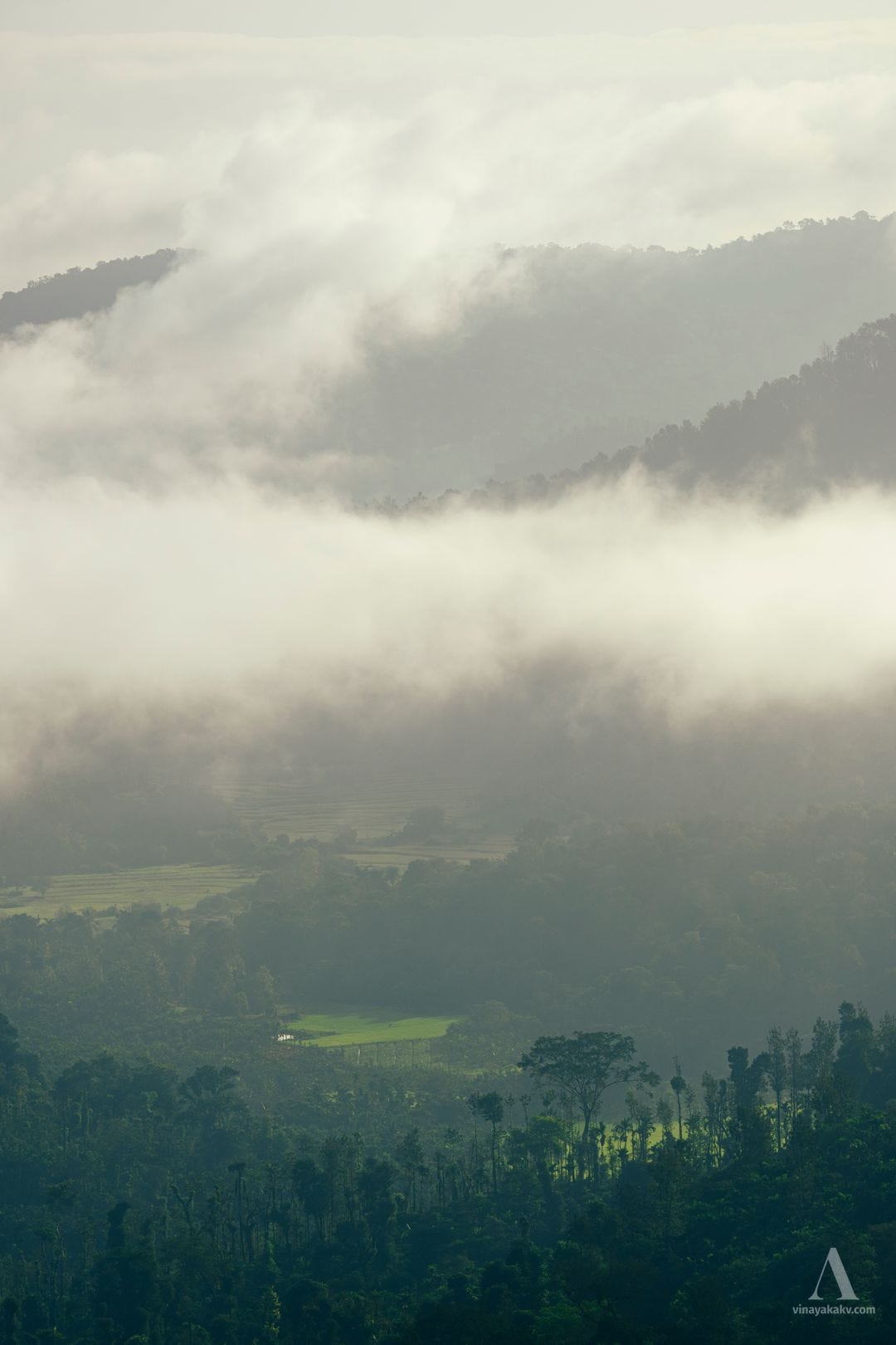
We started around 7 AM, and our route passed through the slopes of the Western Ghats. Near Hirebyle, where we hoped to see the Chandradrona Range, we had to make do with the sight of a mist-covered valley.
Continuing our journey, the view of Ballalarayana Durga near Kelagoor was truly majestic.
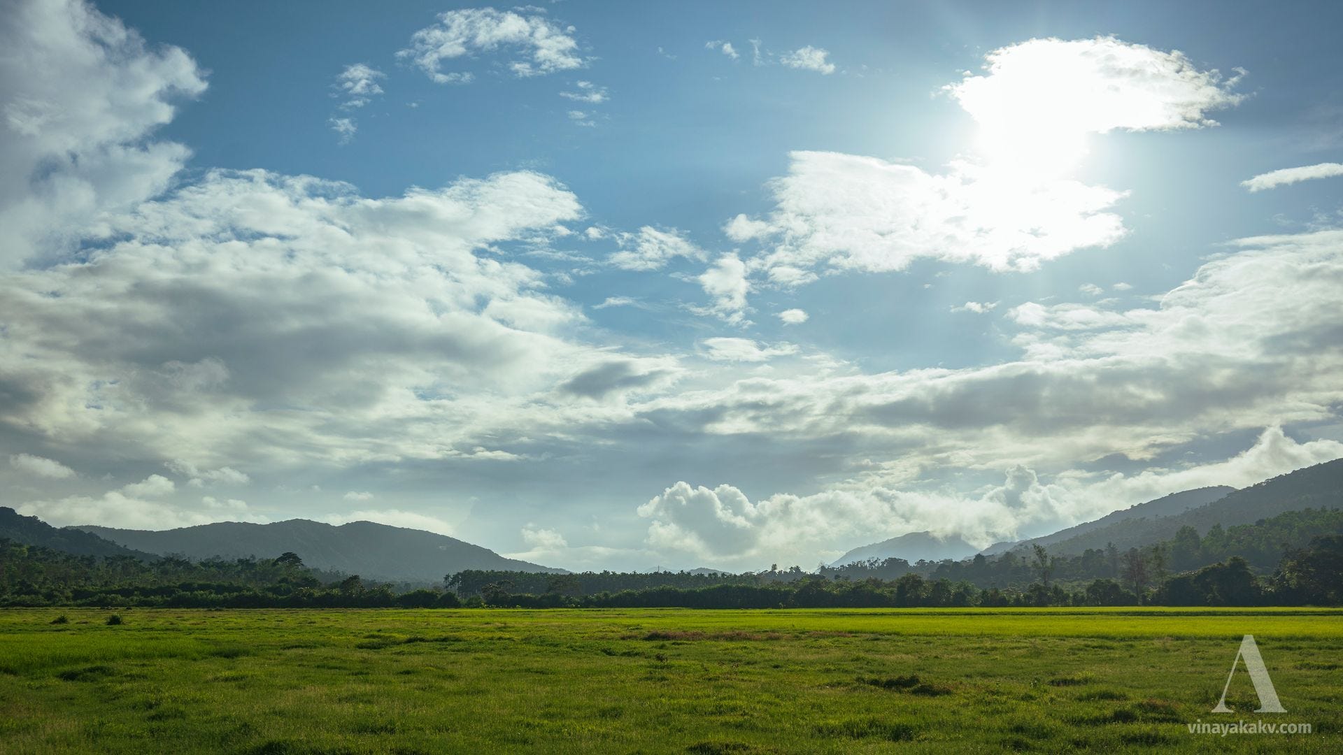
We stopped for a quick breakfast in Kottigehara, where we enjoyed a pleasant view of rice fields with small hills in the backdrop.
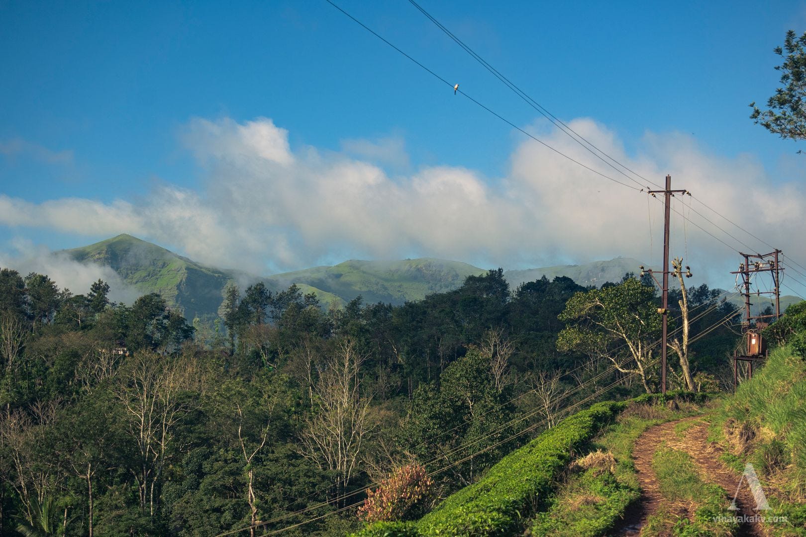
As we approached Devaramane (meaning "God’s home"), the landscape became less forested, giving way to Shola grasslands, resembling the grasslands of Kuduremukha National Park.
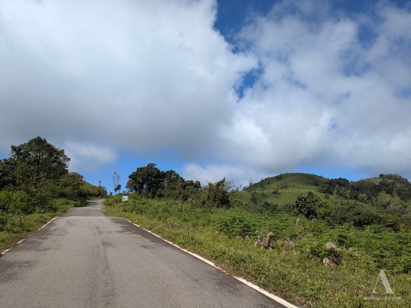
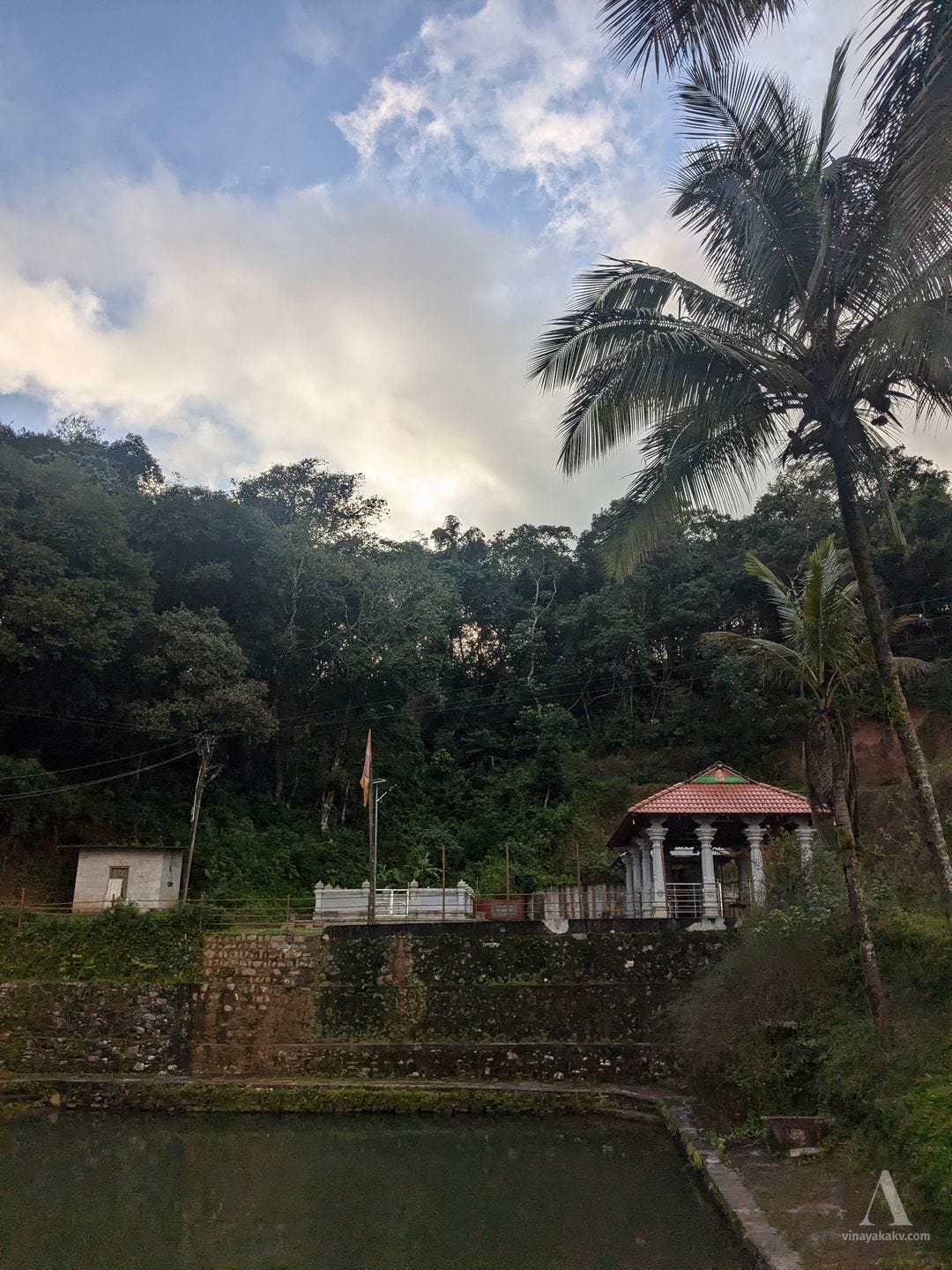
Upon entering Devaramane, we were greeted by the sight of transmission towers, a temple and its lake, and a viewpoint nearby. The viewpoint was just a short climb from the road.
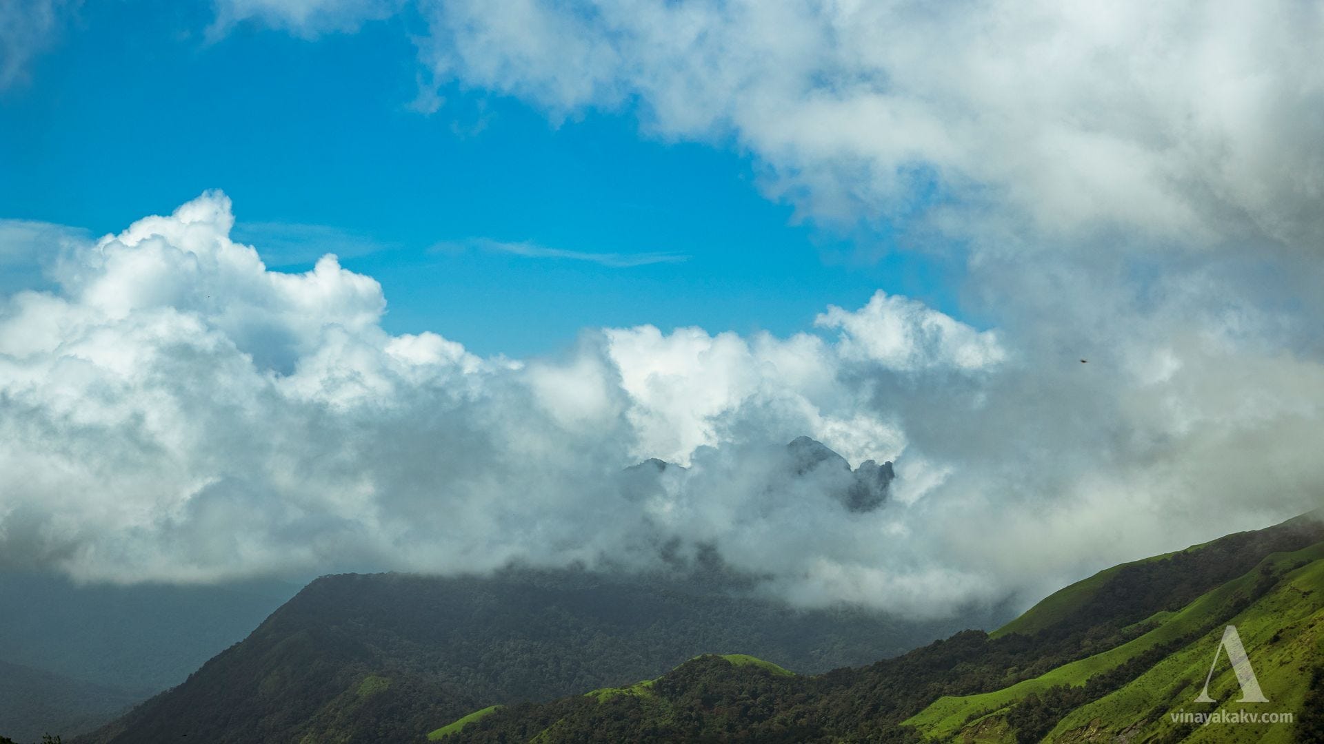
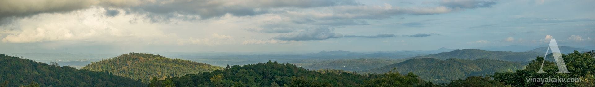
The Viewpoint
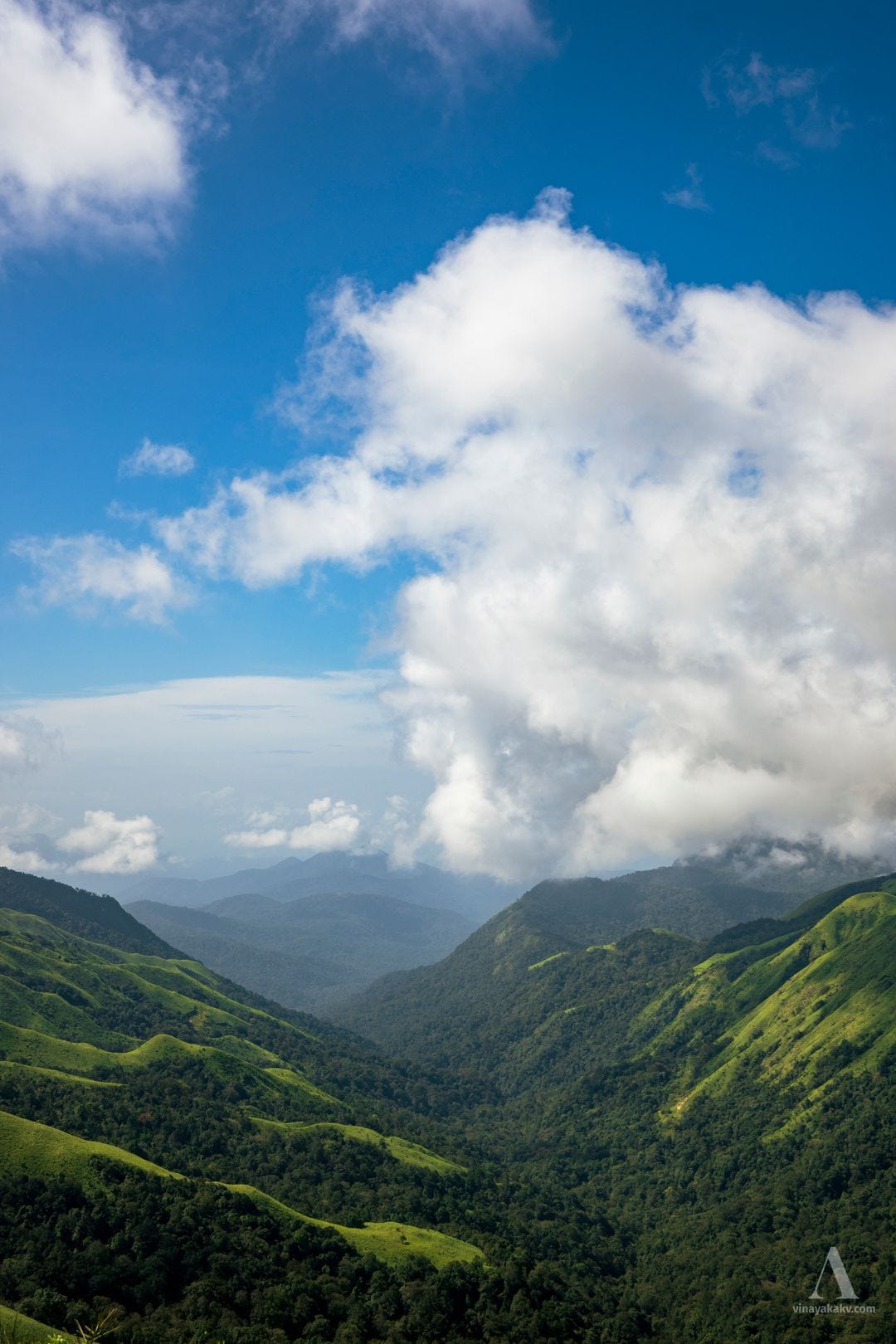
The Devaramane viewpoint is located on one of the hills overlooking a deep valley.
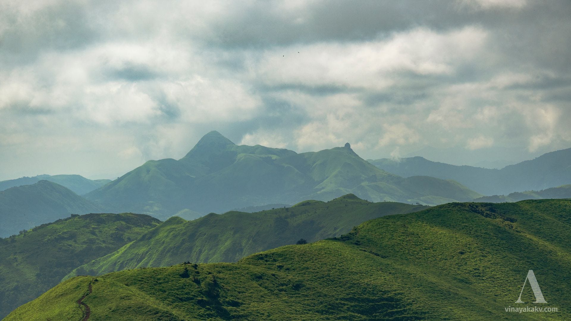
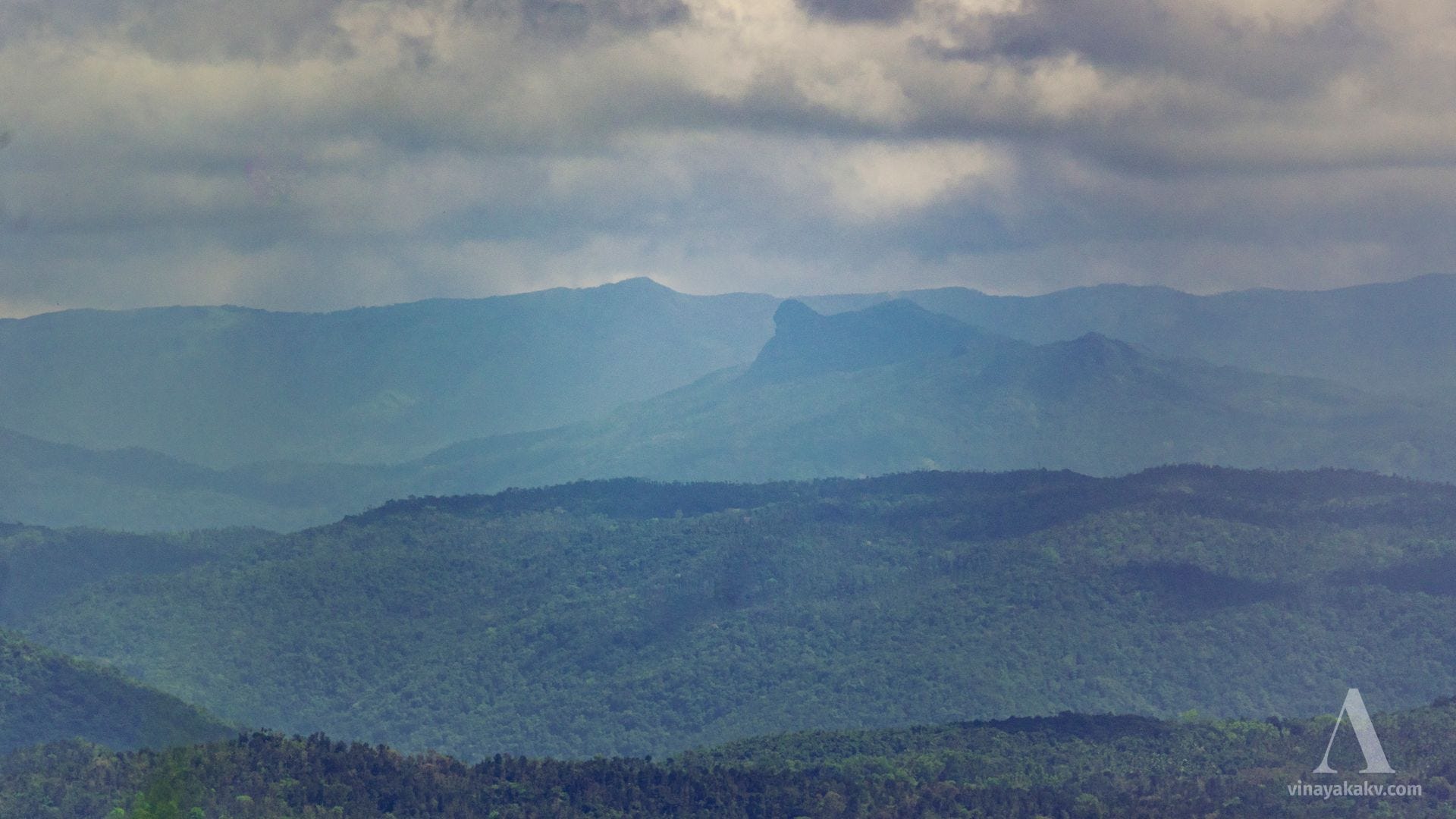
From this vantage point, the distinctive rock peak of Ettina Bhuja (meaning Ox’s shoulder, 1163m) briefly emerged from the mist during our visit.

The view of Jenkall Betta (1355m) with its prominent Deepadakallu rock peak (1249m) is stunning. On clear days, this mountain is visible from Mudigere bus stand.
The rocky summit of Amedikallu (1254m), though covered by cumulus clouds, revealed its peak rocks briefly, allowing us to catch a glimpse for a short while.
This peak, along with Jenkall Betta, appears as sharp twin summits when viewed from Surathkal on the coast, creating a striking silhouette against the horizon, but they are visible only on clear days.
While the peaks of Kuduremukha (1894m), Kumaraparvata (1712m), and Metriparvata (1659m) would have been visible, they were covered in clouds. However, we caught a brief glimpse of the Chandradrona range, with Mullayyanagiri (1930m) peeking through the clouds.
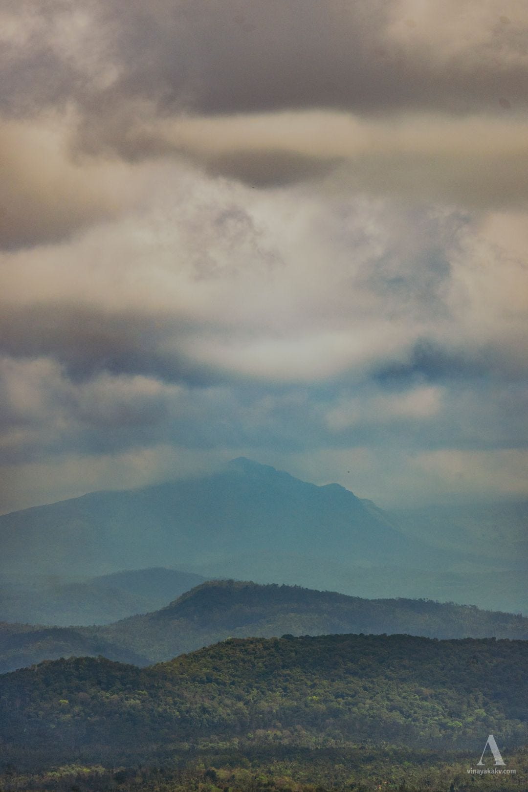
The sharp peak of Devirammana Betta (1740m) in the same range is captivating. Since it sits slightly lower than the others, it often remains clear of clouds.
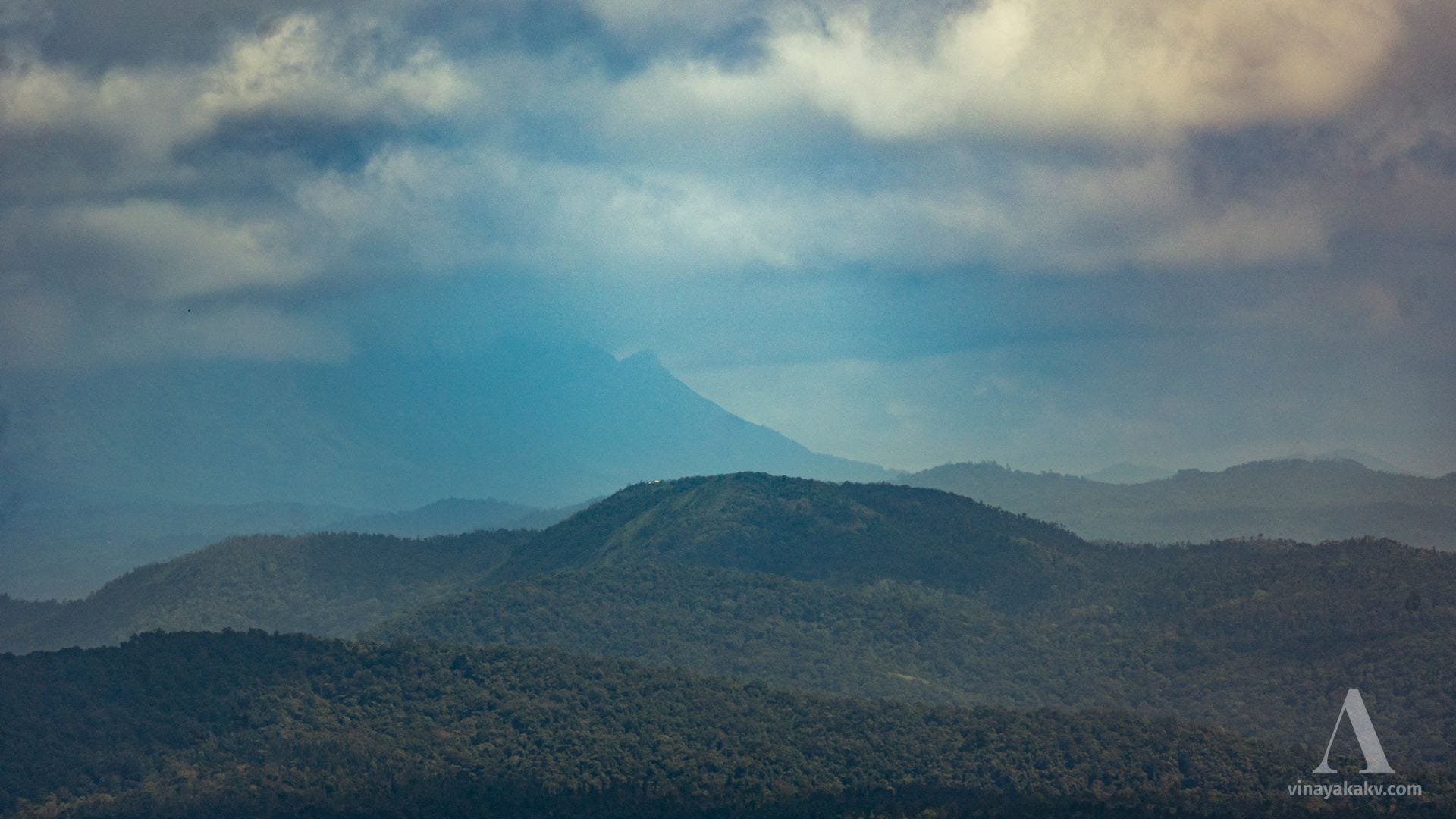
The side ranges of Chandradrona feature some intriguing rock formations, particularly one (~1590m) near Muthodi Estate.
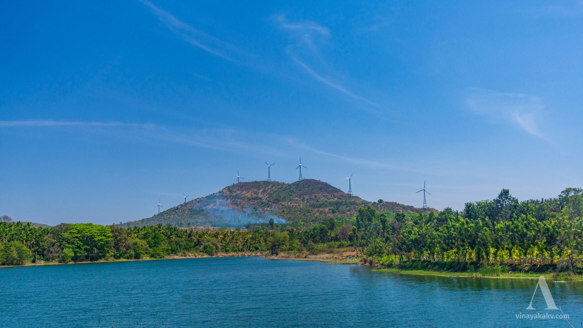
We could also spot mountains outside the core Malnad region. Among them, Seegegudda (1300m, 55km line-of-sight distance), with its windmills atop, stood out.
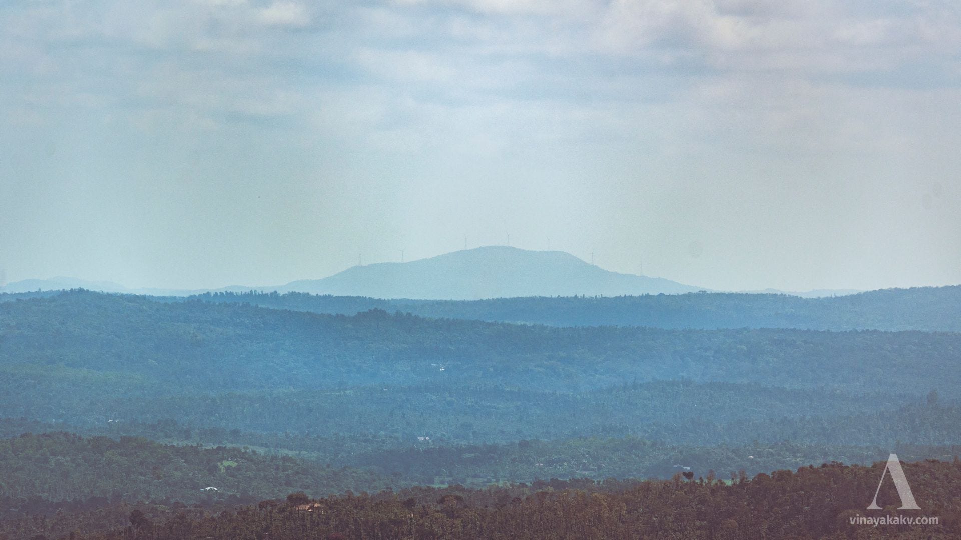
Seegegudda is also visible from the roadside on the route from Belur to Hassan, providing a picturesque backdrop to Kalkere Lake.
Life
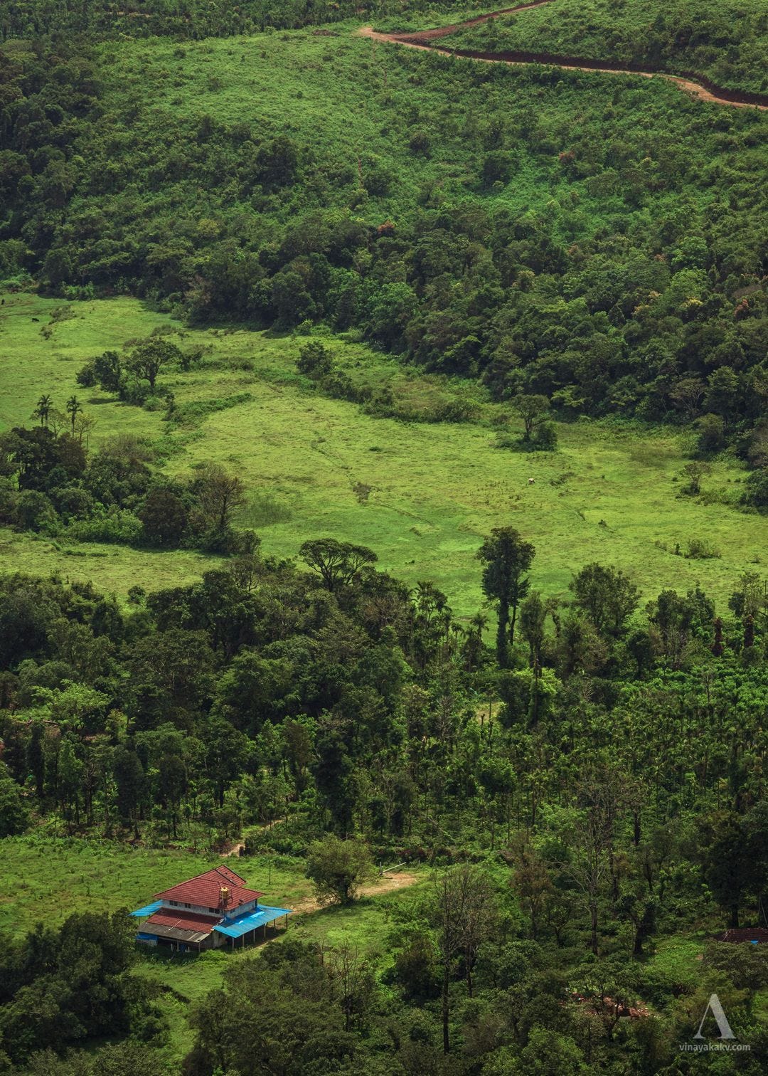
The elevation, terrain, and rainfall create ideal conditions for growing coffee and areca nuts. Due to the harsh and extreme weather, human settlements in the area are sparse.
Despite appearing uniform, the Shola grasslands are home to a variety of plant species. Among them, Impatiens bloom during the monsoon, adding a striking touch to the landscape.


The grasslands are dotted with shrubs, herbs, orchids, lichens, mosses, and fungi, some of which are endangered. Using Google Lens, we identified a few species:
Carissa carandas (ಕರ್ಮಂಜಿ ಹಣ್ಣು1), whose fruit is used for pickles.
Murdannia semiteres, known for its small, attractive flowers.
Eriocaulon tuberiferum, with star-like leaves and small black and white ball-shaped flowers.


This rich plant life, in turn, supports a variety of insects and herbivores. However, we didn’t encounter much wildlife during our visit.
The Return Journey
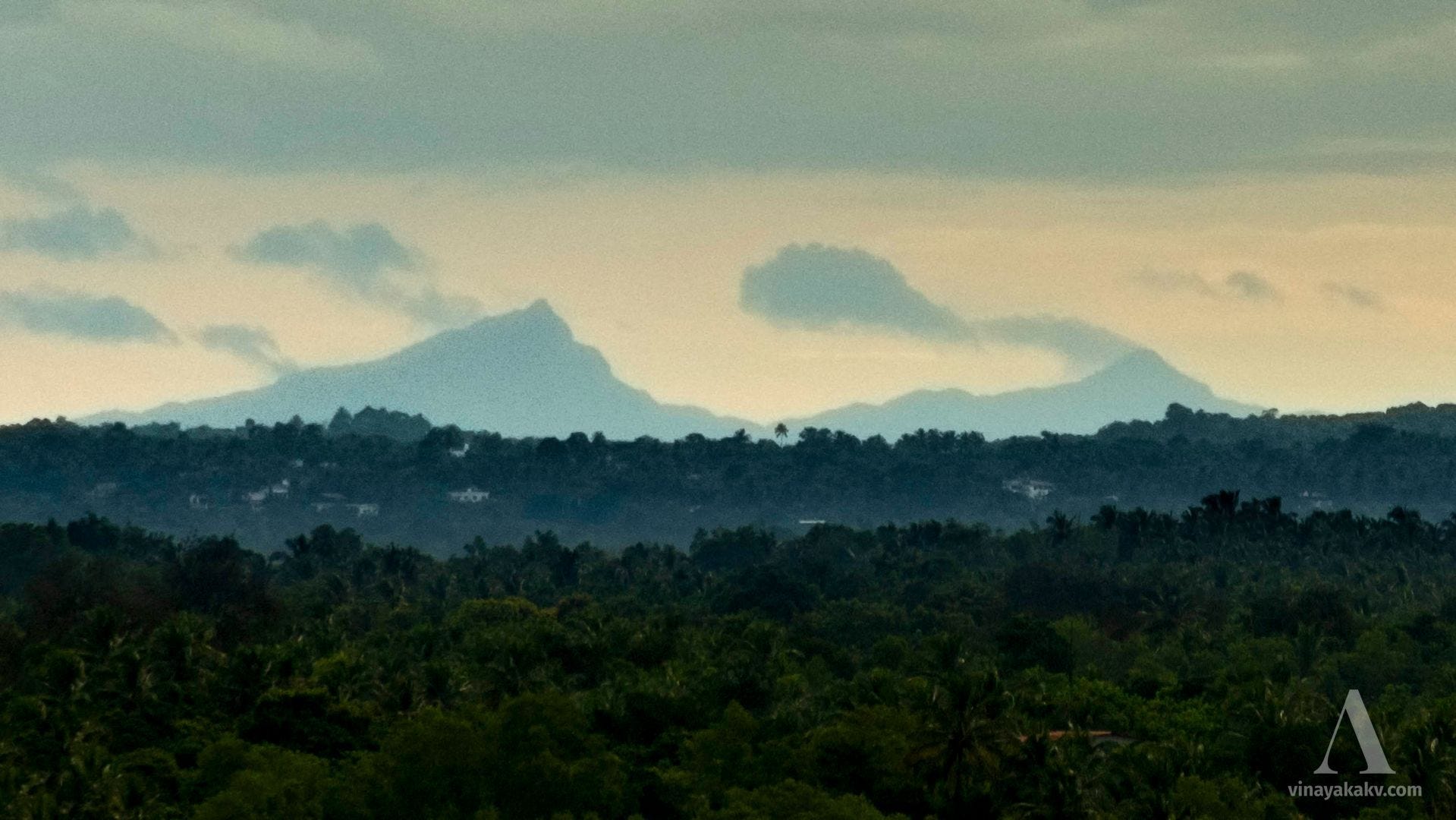
After visiting Devaramane, we continued to our original destination, Mudigere. From near the bus stand, we finally had a clear view of Metriparvata, which we had hoped to spot earlier at Devaramane.
On our return to Kalasa, we decided to visit the source of the Hemavati River, located atop a mountain. The river begins as a small stream, then collects in a small lake before cascading down the mountain and into the plains.
The mountain where the river Hemavati originates, though completely forested, offers a great view of the surrounding hills from a clearing. We enjoyed a panoramic view of the smaller hills around Mudigere and Sakaleshpur.
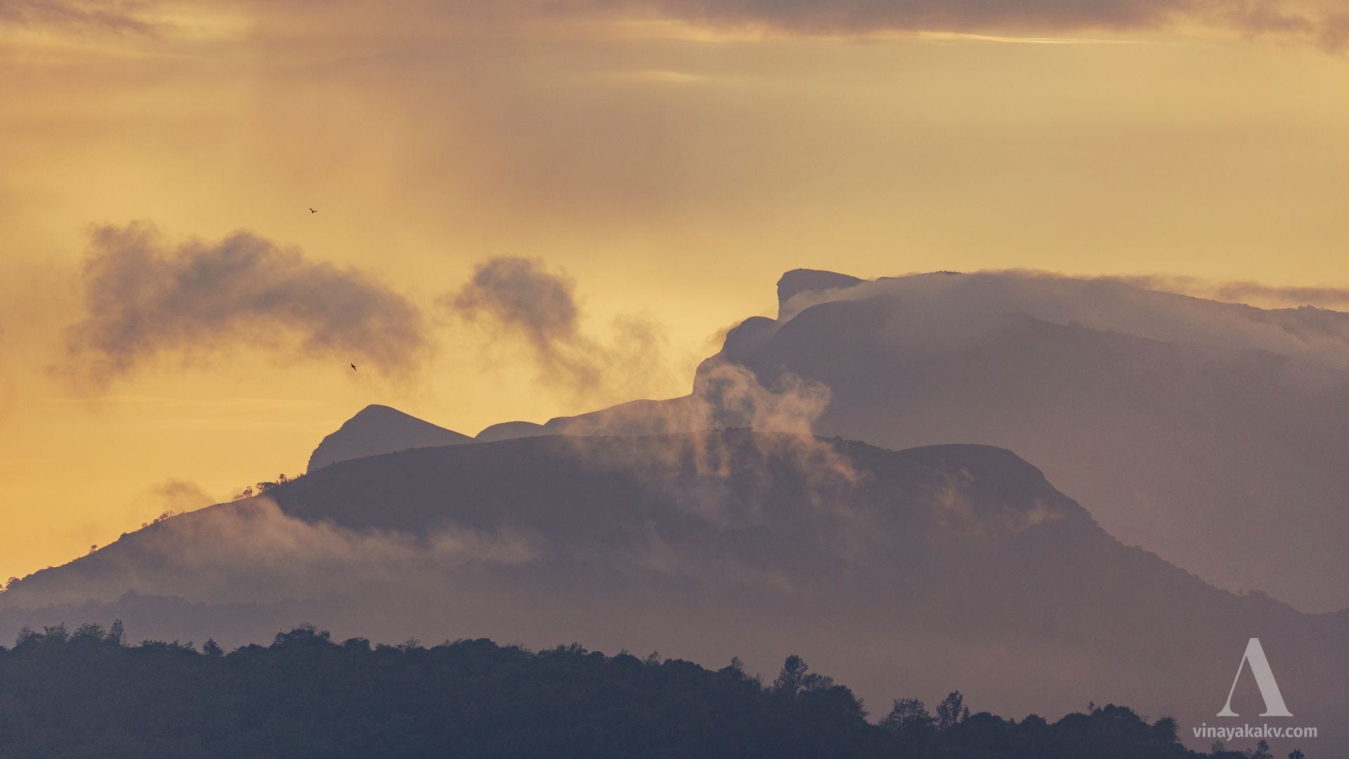
On the other side, where the road descends to Javali, we caught sight of the flat peaks of Ballalarayana Durga with Kuduremukha’s jagged summits in the background. The recent rainfall had cleared the clouds, and the lingering mist created a magical effect.
The close-up photo of the Kuduremukha mountains turned out to be magnificent, with rising clouds over the summit adding a dramatic and intricate appearance.
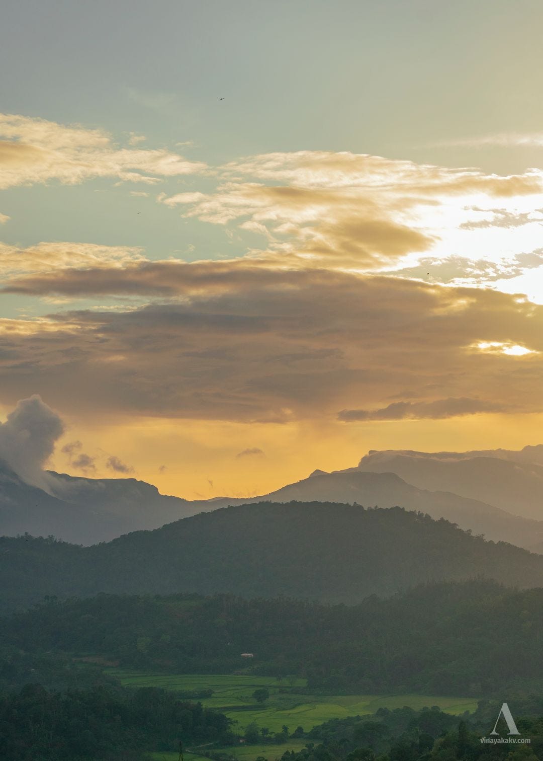
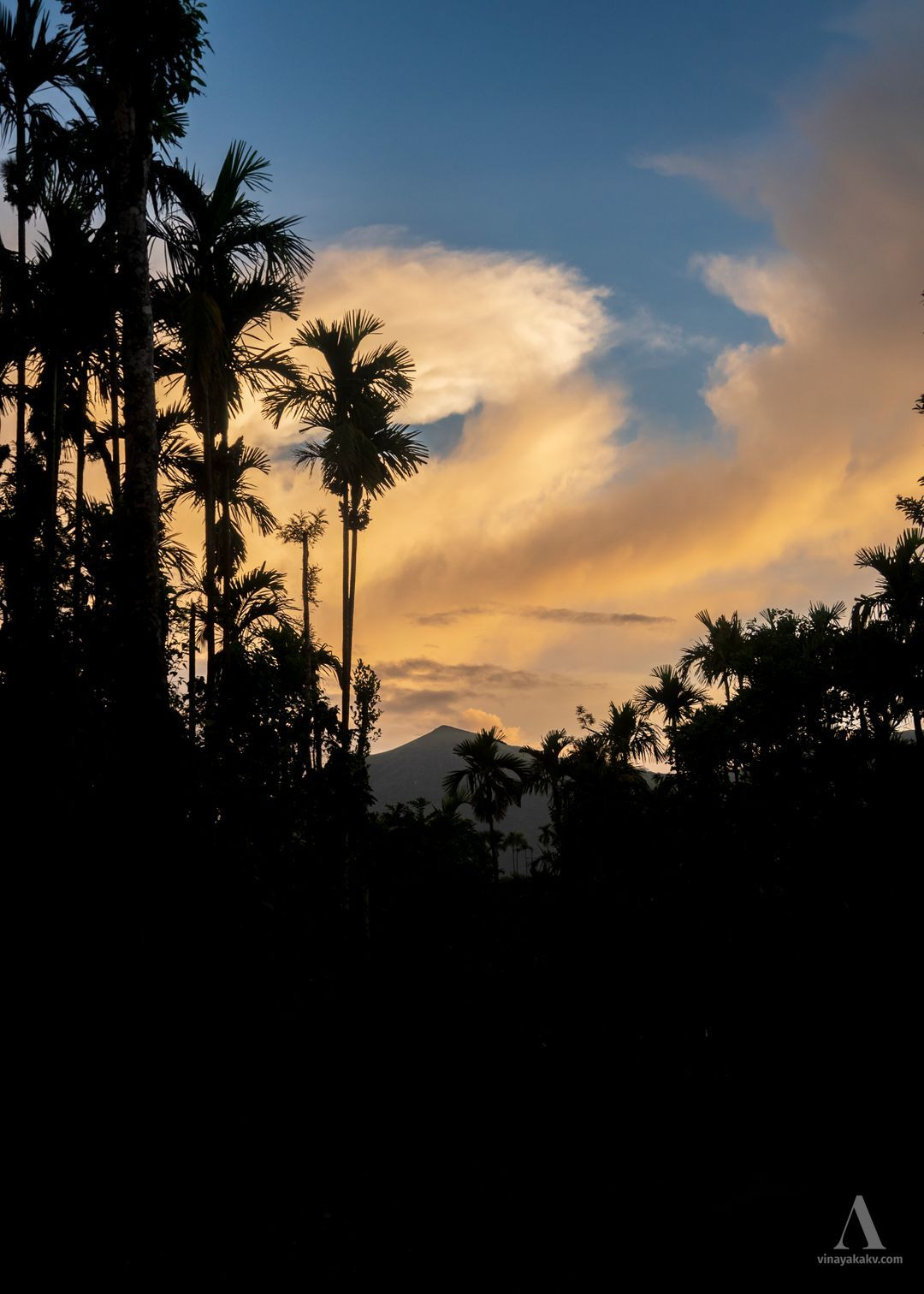
As it was getting late, we didn’t stop anywhere else on our way back. The final photo of the day was of a sky bathed in golden hues, illuminated by the remnants of a thunderstorm — a perfect ending to the day.
The Journey
During our journey, we traveled through three river basins of South India: Krishna, Kaveri, and the West Coast. The river Hemavati is located near the border of the Kaveri catchment and forms a significant tributary. The Kalasa region hosts the river Bhadra. The river Bhadra, along with its twin river Tunga, together forms the Tungabhadra River, which is a significant tributary of the Krishna River.
Devaramane is situated in a location where, weather permitting, we can see most of the tall mountains of Karnataka. These include Mullayyanagiri, Bababudangiri, Kuduremukha, Kumara Parvata, Mertiparvata, and Kotebetta. In addition to these, numerous other mountains of the Western Ghats are also visible.
Although the staff at Devaramane insist that tourists keep the place free of trash, visitors often do not comply. This mentality needs to change if we want these places to remain pristine and enjoyable for future generations.